This documentary was made possible by Three Wise Monkeys in collaboration with Zoological Society of London, Melissa Schiele and Tom Letessier.@officialzsl https://www.facebook.com/officialzsl/@ThreeWMonkeys https://www.3wm.tv/https://www.facebook.com/ThreeWMonkeys@explorer_mel@TomLetessier
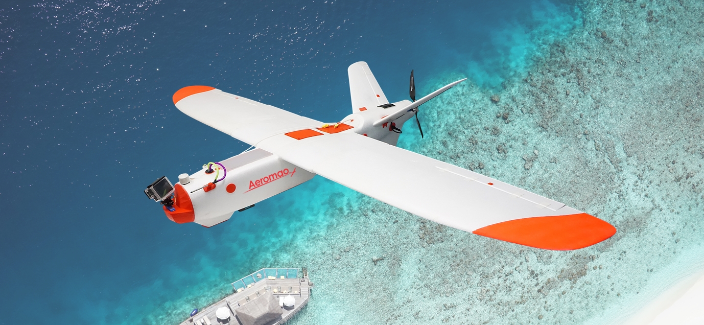
Aeromapper Talon Amphibious
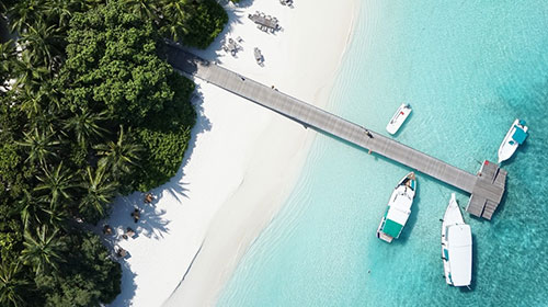
Aeromapper Talon Amphibious proudly supports conservation efforts in Marine Protected Areas against illegal fishing.
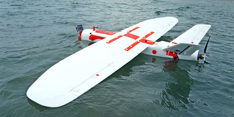
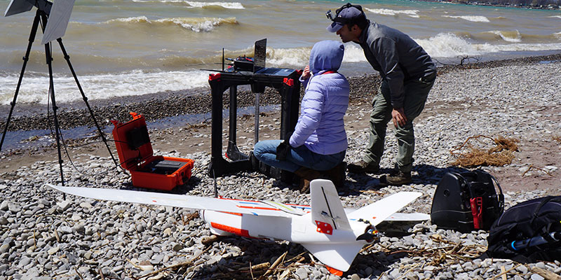
The Amphibious version of the Aeromapper Talon allows maritime operations by autonomously belly landing on water. It’s the perfect solution for aerial observation, data collection and mapping thanks to its dual camera set up and video link range up to 20kms.
The Aeromapper Talon Amphibious is a Transport Canada Compliant drone.

Up To 1.5 hr Endurance

BVLOS Capable (+30 km link range)

20 Mp Stills

40 Km/h Wind Resistance
Long Range Links (+30Kms)
Why Choose The Aeromapper Talon Amphibious
Expand your operations like never before by using lakes, rivers, and oceans as airfields.
Pack the Aeromapper Talon Amphibious drone on a boat and head to those islands that were impossible to map before, or survey along 30km of coastline that were unreachable by land, monitor the amount of algae that spread over the lake or finally get to survey that impenetrable marshland, or search those bird populations with its real-time video system.
How does it work? The Aeromapper Talon Amphibious is fully waterproof, and its simply unsinkable. Its extreme buoyancy keeps the flotation line low, all its access doors and ports are cleverly designed to keep water out. Even in the rare case of water ingestion, all components are adequately protected against water, including salt water. Its internal design has evolved for more than 2 years and now offers even better protection and weight savings, which translates into better flight performance, more endurance and super-easy maintenance if required.
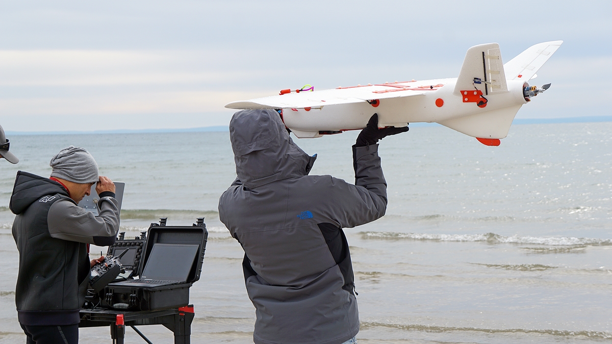
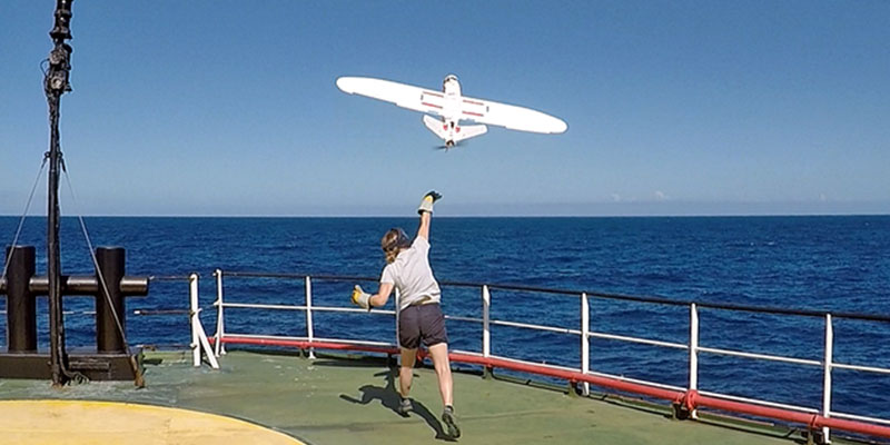
The drone allows for easy operation thanks to its autonomous take off upon hand launch, autonomous navigation, and auto land.
Best of all, forget about paying an arm and a leg for a dependable – portable amphibious drone that are usually only a luxury of military budgets. The Aeromapper Talon amphibious comes in an affordable package and its components are modular and future-proof. Its rugged and durable construction allows for repeated use and tough handling and still being very easy to repair in the field.
Capture 20Mp stills or HD video facing down, or add the optional forward-looking camera with long range real-time video link of exceptional image quality. The forward-looking camera can be panned from the hand-held remote control to look sideways and lock on points of interest by loitering the UAV around them. The standard range of the video signal is 15-20 Km but it can be extended to 40km using our 24 dBi parabolic antenna (optional).
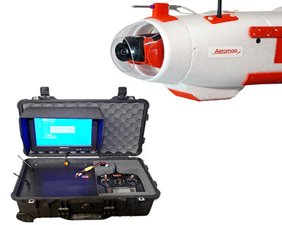
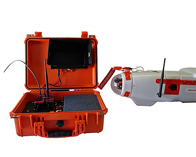
The forward-looking camera system comes complete and ready to use, including the heavy-duty Ground Control Station, with 10’’ LCD monitor and diversity receiver.
Best of all, you can still parachute down on dry land when required. The Aeromapper Talon Amphibious version also features our standard long-range capabilities for BVLOS (Beyond Visual Line of Sight operations) (+30Km control and telemetry links).
Talon Amphibious Key Features
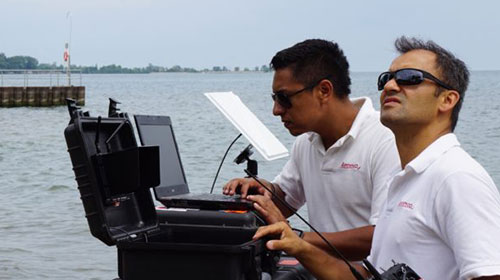
Patrol large areas easily with the waterproof real-time video system with a link range of 20kms, extendable to 40km with parabolic antenna (Ask us for details). The system is delivered with a complete Ground Control Station.
The Aeromapper Talon Amphibious also includes long-range capabilities for BVLOS operations (Beyond Visual Line of Sight, +30Km control and telemetry links). Additionally, it is now equipped with an ADS-B module: the drone reports live the location and altitude of nearby manned aircraft so all operators can safely share airspace.
The Aeromapper Talon Amphibious has a waterproof rating of IP67 (dust tight and protected against immersion). Even in the event of water ingestion, the internal components are individually protected. The system is made to last and support abuse in tough marine environment.
Fly far with confidence: if you are flying Beyond Visual Line of Sight or in extreme conditions such as high winds the Aeromapper Talon can also be equipped with a convenient Locator beacon (optional). Alternatively, the UAV reports to the GCS the last known coordinates.
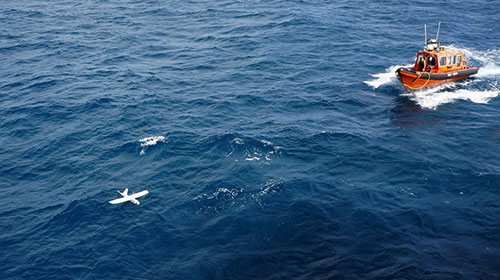
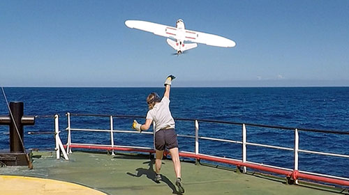
Operate in offshore, flooded areas, rivers, lakes, from a moving boat, without ever setting foot on land. Easily hand-launch from any boat and recover easily from the water.
“Its improved design and our philosophy of constant improvement has made the Aeromapper Talon Amphibious the trusted drone for long range marine operations from both land and vessels, for several organizations around the globe. When the crews are out in the middle of the ocean they need a dependable machine that works. That is the role the Aeromapper Talon Amphibious serves.”
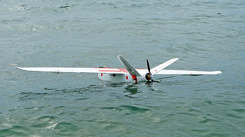
- Construction: EPO foam (durable, easy to repair, carbon fiber reinforced).
- Wingspan: 2 m.
- Weight: 3600 grams.
- Endurance: 1.5 Hours.
- Launch: Very easy to hand-launch.
- Takeoff: Fully automatic.
- Landing: Automatic belly landing on water or land.
- Range: +30kms. Tested in real BVLOS flight operations (Beyond Visual Line of Sight).
- Max. Altitude: About 4500 masl.
- Cruise speed: 62Km/h.
- Camera: 20Mp stills or up to 4K video, nadir orientation. Forward looking payload optionally available.
- Flight modes: Manual, Stabilize, Return to Home, Fly be Wire (automatic holding altitude and airspeed), Auto.
- Wind Tolerance: up to 45 km/h. for flight and autonomous belly landing. 25km/h for parachute landing.
- Maximum speed: +85 Km/h – Great stability and minimal roll & pitch oscillations in gusty conditions = no gimbal required for cameras & sensors.
- Failsafe: Automatically returns to home & loiter upon loss of RC link. Other fail-safe routines available.
- Telemetry: Battery status, alt, ground speed, compass, altitude, distance traveled, time on air (speech enabled), and more than +200 parameters more.
- Moving map display/telemetry: Drone position and heading, commands on map, fly to point on map, altitude changes, remote spot camera trigger, mission route, and more.
- Weather: All-weather performance. -20°C to +40°C.
|
GSD (ground resolution) |
Altitude AGL (meters) |
Area coverage per flight |
|
1.6 cm/pixel |
85 m |
5.2 km2 |
|
2.4 cm/pixel |
125 m |
8 km2 |
|
4.8 cm/pixel |
250 m |
14.7 km2 |
|
7.8 cm/pixel |
400 m |
25 km2 |
|
11.7 cm/pixel |
600 m |
35 km2 |
- Area coverage per 90 min flight, including takeoff and recovery flight time. Larger areas can be covered in several flights in the same day.
- Calculated with 30% side overlap.
- Calculated using the standard 24 Mp camera & lens provided.
- For 3D terrain models side overlap must be minimum 60%, reducing estimated area coverage per flight.
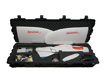
- Aeromapper Talon Unmanned System Ready to Fly.
- One set of batteries for 2 hrs of flight time.
- +30 Km Link system.
- Sony 20mp camera.
- ADS-B live air traffic data system.
- Lipo Battery Charger.
- User’s Manuals & Documentation.
- Heavy duty carrying cases.
- Mission Planner Software.
- Unlimited Support after sale.
Optional Additions and Pricing
Aeromapper Talon Amphibious complete mapping system ready to fly:
’Includes 20 Mp camera, carrying case, batteries, battery charger, accessories, hand-held controller with long range system, ADB-S upgrade, Manuals and Documentation, mission planning software, support package, 1 year Limited Warranty.
Contact us
“Eyeshot Pro” real time video downlink system:
Integrated by Aeromao Inc, the Eyeshot Pro features swappable day or Thermal Infrared cameras with real time video downlink to ranges up to 20km, extendable to 40kms upon request. Different flight modes allow for easy “patrolling” of the field making it an affordable high end solution for observation and surveillance tasks. The stock camera also records HD video onboard, and Flir Vue Pro series of cameras are available as a swappable sensor. Camera settings can be controlled remotely via long range data link. Includes complete GCS (Ground Control Station) ready to use.
Contact us
PIX4D Mapper software: $4,990 USD.
Aeromao is an official partner of Pix4D. The Pix4DMapper is the No. 1 photogrammetry software for drone imagery. Works for any camera, any drone and type of imagery. Transform your images into spatial models, quickly and accurately. Measure distances, areas, and volumes. Extract elevation profile data and perform virtual inspections. Full featured perpetual floating license (1 device). More information here.
Agisoft Metashape
Perform photogrammetric processing of digital images and 3D spatial data generation.Includes a single user license to process unlimited imagery. Features: Photogrammetric triangulation, Dense point cloud: editing and classification, Digital elevation model, Georeferenced orthomosaic, measure distances and volumes, high accuracy surveying, multispectral and thermal imagery processing, and much more.
$3,499 USD
Hands-on flight training:
This training covers UAV preparation, mission planning and principles of image acquisition, preflight checklist, live flying and recovery.
Contact us
Online flight training:
Online training covers UAV preparation review, mission planning and principles of image acquisition, preflight checklist and recovery procedure.
Contact us
Eyeshot Pro system:
The system consists of a waterproof camera setup with controllable panning, onboard video transmitter, Ground Control Station with redundant receiver capability, 7’’ LCD monitor conveniently integrated into a highly mobile rugged carrying case with swappable rechargeable batteries capable of many hours of operation in the field. The GCS is designed for fast deployment and redundant link technology to guarantee a strong video signal independently of UAV orientation at long distances.
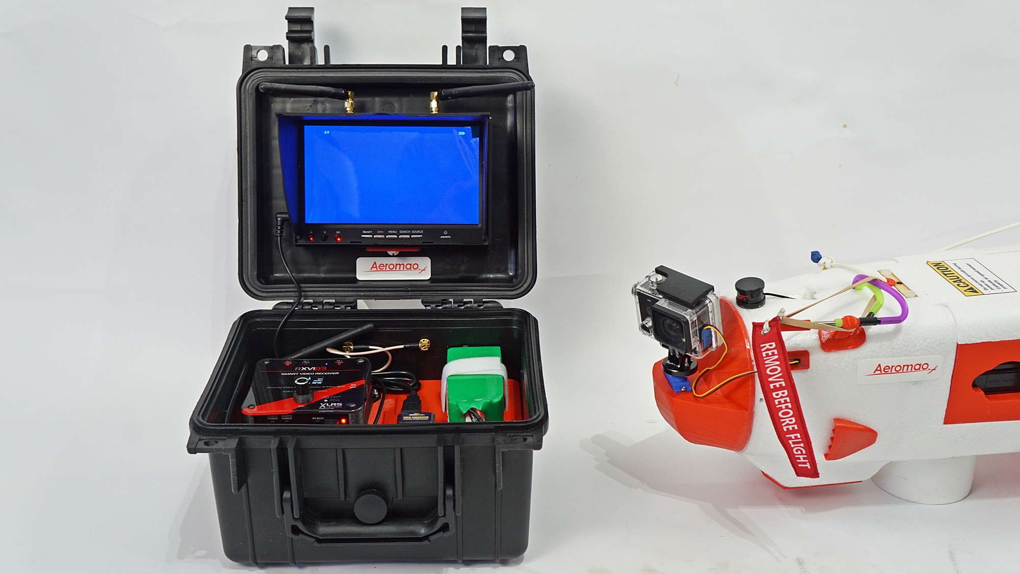
The System Includes:
- Standard video link range: 15-20 Km.
- Camera records video in HD.
- All onboard system components are waterproof.
- Camera panning is controllable from a hand-held controller for maximum searching coverage. Keep a constant eye on a point of interest by panning camera sideways and loiter over the target while drone automatically maintains altitude and airspeed.
- The camera system and Ground Control Station is plug-n-play. Includes: 7’’ LCD monitor, diversity receiver, long range antennas, power source, and waterproof case. Band: 2.4 GHz.
Micasense Altum
The Altum integrates a radiometric thermal camera with five high-resolution narrow bands, producing advanced thermal, multispectral and high-resolution imagery in one flight for advanced analytics, calibrated and synchronized, perfect for advanced analytics.
Its Five high-resolution lenses allow you to get detailed plant health imagery (5.2 cm GSD) and detailed Digital Surface Models all from 400 ft. This camera is swappable with all other sensors available for this drone.
For detailed information on this camera go to: https://www.micasense.com/altum
The Altum is delivered ready to use with 128 GB external storage device (USB 3.0), calibrated reflectance panel, DLS 2 light sensor with integrated GPS, cables, and swappable mount.

