In the last few months, Emlid has added new surveying tools and coordinate systems to Emlid Flow and Emlid Flow 360 and simplified access to your Reach in a browser. Make sure you have updated your Reach firmware to version 31 and Emlid Flow to version 9.0 and explore the details.
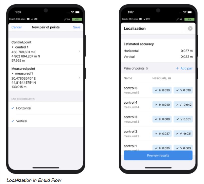
Use localization to calculate or adjust local CS parameters
Try the new localization feature in Emlid Flow. It’s helpful when you don’t have the precise parameters of the local coordinate system your project should conform to, but you have the known points in that CS. You can measure these points with Reach and apply localization in Emlid Flow. The app chooses the calibration algorithm that provides the best accuracy and lets you quickly edit the localization parameters.
Unlock localization and other professional tools in Emlid Flow with the free Survey plan trial.

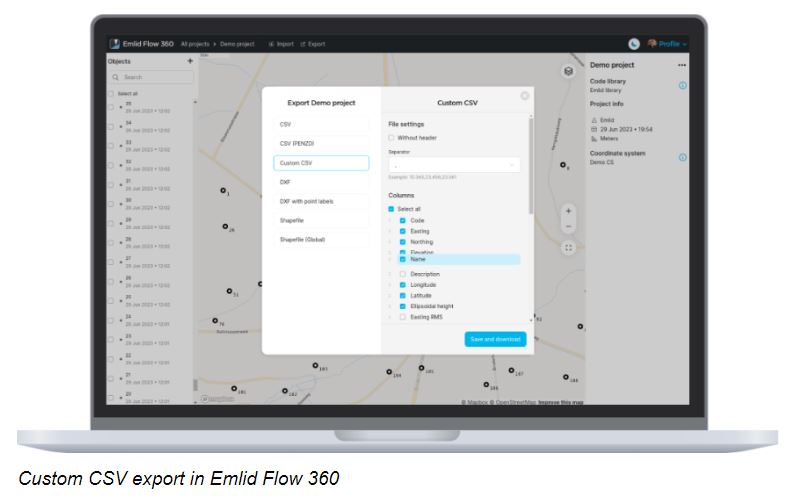
Export your CSV fully compatible with CAD or other apps
Now you can customize the exported CSV in Emlid Flow 360 to make your file compatible with CAD, photogrammetry, or other professional software. Select the included columns, rename and reorder them, choose the separator, and remove the file header if needed. Try the Survey plan subscription to use this feature.

Survey in your local coordinate system
We’ve extended the local coordinate system support in Emlid Flow and Emlid Flow 360. Check out the new coordinate systems and datums.
🇮🇱 In Israel: Israeli Grid 05/12 and Israeli Grid 05 coordinate systems, and ILUM2 height vertical datum
🇦🇹 In Austria: coordinate systems based on MGI datum using a 2021 version of transformation
🇹🇭 In Thailand: Kolak-1915 height vertical datum that uses TGM2017 geoid
🇮🇹 In Italy: Genoa 1942(South Tirol) height vertical datum
🇬🇪 In Georgia: Baltic 1977 height vertical datum
🇿🇦 In South Africa: Hartebeesthoek94 datum and South Africa SAGEOID2010 height vertical datum are now available in Emlid Flow 360, just like in the app.
Explore the details in our Docs.
|
|
|
