Description
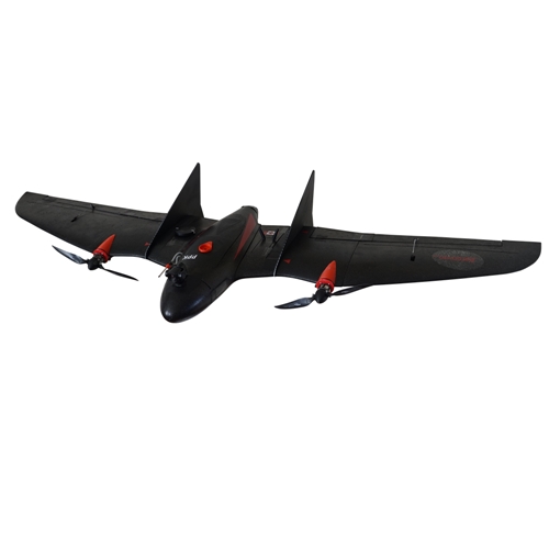
Now with dual motor setup!!
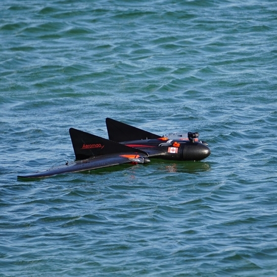
The Aeromapper Talon UAV system is a turnkey fixed-wing, survey grade system available with a multitude of swappable payloads that range from mapping & surveying, to inspection, monitoring, surveillance, PPK mapping, agriculture.
With a 2-hour flight endurance and a new 61 MP Sony mapping camera, it enables large-scale projects to be completed faster, maximizing ROI thanks to its extremely competitive price. Enhanced with the Emlid Reach M2 multi-band PPK UAV Mapping Kit, it delivers centimeter level accuracy and high-resolution deliverables. Operators can map 10 times more area compared to small multirotor drones, or more than 480 hectares per flight at 1.5cm/pixel resolution, all while ensuring centimeter-level accuracy for the most demanding projects.
- Transport Canada compliant drone
- Rugged design: the Aeromapper Talon is built very strong and rugged, so it can withstand many years of field work.
- Available with all Emlid Reach M2 PPK UAV Mapping kit for centimeter accuracy with no GCPs.
- The UAV system is all-weather, safe to fly in light rain, fog, snow, artic or hot weather up to 45oC.
- Up to 2 hr of maximum flight endurance
- Available now with ADS-B
- Sensors available: up to 61 MP mapping RGB camera or HD long range video link for surveillance or surveillance payloads
- Long range data link: up to 30km link distance away from GCS. Ideal for BVLOS operations.
- 5 minutes setup time in the field. Very easy to operate.
- Hand launch; parachute recovery or automatic belly landing.
- Fully autonomous.
- Maps 480 has per flight at 1.5cm/pixel resolution.
- No training necessary.
System includes:
- Aeromapper Talon Unmanned System Ready to Fly.
- Batteries and battery charger.
- 30 Km Link system.
- User’s Manuals & Documentation.
- Heavy duty carrying case.
- Mission Planner Software.
- ADS-B live air traffic data system.
- One Battery set
PURE-BREED
Its pure-breed fixed-wing design offers unmatched performance and simplicity, standing out against more complex multi-engine VTOL designs that are expensive, cumbersome, fragile and complex. The Talon’s compact, clutter-free design makes preparation and operation effortless, allowing it to be flight-ready in just minutes.
Specifications:
- Construction: EPO foam (durable, easy to repair, carbon fiber reinforced).
- Wingspan: 2 m.
- Weight: 3500 grs.
- Endurance: 2 Hours in standard configuration (single mapping camera).
- Launch: Very easy to hand-launch.
- Landing: Parachute or automatic belly landing.
- Communications link range: +30kms. Tested in real BVLOS flight operations (Beyond Visual Line of Sight).
- Max. Altitude: About 4500 masl.
- Cruise speed: 58 Km/h