Description
MicroSurvey’s FieldGenius presents state-of-the-art functionality, sans the staggering price tag traditionally associated with survey software. MicroSurvey FieldGenius stands as straightforward and user-friendly survey software. Through MicroSurvey FieldGenius, all functionalities are conveniently reachable from the Map Screen. There’s no necessity to sift through menus to locate desired functions; everything is readily accessible. Opting for MicroSurvey FieldGenius Premium grants access to every feature without extra charges. With the premium version, Basic, Total Station, Robotic, GNSS, and Roading are all instantly available at no supplementary cost.
1-year maintenance support contract included for Standard and Premium Editions
- Code-free linework
- Best-in-class user interface
- Works on more displays/devices
- Productivity tasks
- Calculation tools
- Part of the perfect workflow
- Intelligent Display
- Brand Neutral: Compatible with Hemisphere, Leica, Stonex, Novatel and More
- Runs on Windows 10, CE 5/6/7 and Windows Mobile 6.x
Edition Differences
https://www.microsurvey.com/products/fieldgenius/pricing/#software
Microsurvey Field Genius is the perfect software/app for Emlid GNSS receivers for advanced users.
Buy the Microsurvey FieldGenius Annual Maintenance Subscription (AMS) package here
Product presentation
FieldGenius Overview:
Microsurvey Software
MicroSurvey software has established a reputation for delivering software packages tailored to the geomatics, survey, civil, and forensic sectors. Renowned for their dependable solutions, backed by exceptional support, MicroSurvey ensures robustness and reliability in every aspect. Whether you seek a field software package, an office CAD drafting solution, or a post-processing quality assurance tool, MicroSurvey offers a fitting solution.
Based in Kelowna, BC, MicroSurvey has proudly served as a Canadian company since 1985. They take pride in offering a comprehensive field-to-finish solution, equipped with the necessary tools for experts while remaining user-friendly for anyone to begin using immediately. With their location in Kelowna, their support operates within North American time zones. This accessibility ensures that should you encounter any challenges in the field, reaching out to them means connecting with a live person ready to assist. Their ethos revolves around empowering people, not machines.
FieldGenius – Field Data Collection
FieldGenius is meticulously crafted to streamline data collection, organization, and staking processes to the utmost simplicity. With over two decades of development, FieldGenius has undergone extensive refinement to ensure all necessary tools are seamlessly integrated into the software.
FieldGenius encompasses modules tailored for GNSS, total stations, robots, and roads. What sets it apart from much of the industry is that the standard version of FieldGenius includes drivers for GNSS and total station instruments. This eliminates the need to purchase separate modules to synchronize with your existing equipment.
Full featured and brand neutral
In the surveying sector, it’s common to operate with a variety of hardware brands. FieldGenius remains impartial, boasting drivers to accommodate most prevalent hardware brands in the current and past markets. It stands as a mature, professional, and feature-rich field survey software, designed for ease of use. Recognizing the high value of skilled employees’ time and the costliness of training new staff, optimizing their productivity with robust field software becomes a prudent investment.
Without such an investment, inconveniences like extended travel times between job sites and the need for frequent office returns for calculations or troubleshooting arise. MicroSurvey FieldGenius, evolving over the past two decades, encompasses all necessary tools for on-site issue resolution across all aspects of the job, from data collection to layout to as-built documentation.
Training employees to proficiently utilize these tools ensures heightened efficiency and effectiveness. Moreover, these skills seamlessly transition when upgrading equipment or switching to a different instrument manufacturer, as FieldGenius maintains compatibility across products. Opting for a workflow-focused approach rather than tethering oneself to specific hardware minimizes the risk of obsolescence and ensures the utilization of all available gear without restriction.
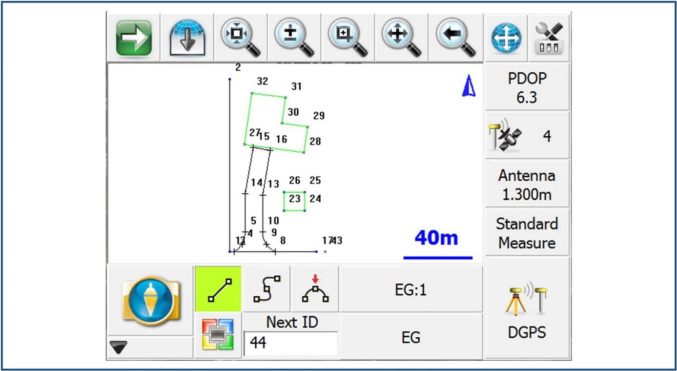
GNSS Linework
Group Code Linework
Teaches itself and intuitive
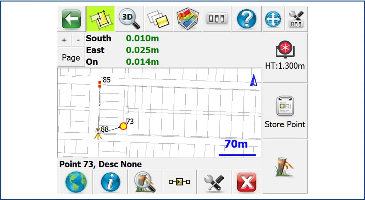
It takes two steps to connect to an instrument, see your mapview and start surveying. All primary survey functionality is driven right from the mapscreen. Use the touchscreen to select an item on the map and a specialized toolbar will display all relevant options. Pick a point to stake it, pick a line to calc an offset or pick an alignment to start roading…everything is there. If that isn’t enough there is a build in help resource that will guide you through any process, and 100’s of online training videos you can watch from anywhere, on any device where you have internet access. Try it for yourself and see just how easy it is to get into FieldGenius.
Inverse Line
Point Toolbar
BASIC EDITION:
- Basics
- Runs on Windows 10, Windows Mobile and Windows CE
- 3D viewing of points, lines, CAD and DTM
- Built in COGO intersections, inversing, offsets and traversing
- Staking lists
- High visibility Graphical Staking Views
- Traverse Closure and balancing
- Traverse recoordination
- Automated Traversing and Multisets
- Attach dxf, dwg,dgn and orthoreferenced images
- Coordination of attached CAD files
- FBK, SDR, SIMA, CR5 Export
- Custom ASCII Import/Export
- Map based, graphical interface
- Real time diagramming with points and linework
- Create, edit and stake points
- Customizable stake shot prefixes and suffixes
- Cutsheet reporting
- Many Reporting Formats
- Raw file viewer/editor
- Encrypted raw files
- Transform points from control
- Point and figure attributes for GIS data collection
- Import or export shape files
- Simple export to CAD formats
- 1-year maintenance support contract included
STANDARD EDITION:
- Total Station Features
- Customizable Target Library for Total Station functionality
- Supports built in GPS on controller
- Full RTK support for base/rover pair or network Rover
- All measurements transformed to plane coordinate system
- Supports RTCM3 transformations from network
- Selectable EDM modes
- Scaled EDM and COGO calc input for full Grid/Ground functionality
- GNSS Features
- Dynamic GPS and Observations toolbars report “live” position and meta data
- Flexible options for setting and revising GPS site calibration
- Compatible with most major manufacturers
- Measurements corrected for Geoid
PRO EDITION:
- Roading Features
- Landxml alignment, DTM surface, cross section and zone staking
- Slope staking
- Automatic Turn to Point
- Robotic search and tracking functionality
- Custom keyboard shortcuts
- Support for most major manufacturers
- Shaded, rendered view of surface, contour and wireframe data
- Realtime surface modeling and staking
- Supports zone widening and super elevation
- Area and volume calculations
- Robotics Features
- Wireless radio and Bluetooth support
- Navigate to stake point
- Realtime tracking in Mapview
What’s new for Fieldgenius? Click here to learn more on the latest version of Fieldgenius.
About MicroSurvey
MicroSurvey develops computer software for Land Surveyors, Civil Engineers, Seismic Surveyors, Mapping Professionals, Police Officers, and Accident Reconstruction Specialists in more than 100 countries across the globe. MicroSurvey is built by surveyors for surveyors
Aeromao Inc. is an authorized dealer for Microsurvey FieldGenius