Aeromao Aeromao Aeromao
  • Home
  • About
  • PRODUCTS
    • VT-NAUT
    • Aeromapper Talon
    • Aeromapper Talon Amphibious
    • Emlid
    • DJI Drones
    • Surveying accessories
    • DJI Drones
    • Remote ID
    • Software
    • Shop
  • Services
  • Case Studies
  • News
  • Contact
  • Shop
  • 1 item

Reach M2 PPK UAV Mapping Kit – Dual Band

“ADTi 50 mm Full Frame Professional Mapping Camera Lens” has been added to your cart. View cart
Reach M2 PPK UAV Mapping Kit - Dual Band
Reach M2 PPK UAV Mapping Kit - Dual Band - Image 2

Reach M2 PPK UAV Mapping Kit – Dual Band

$4,517.00 CAD

Multi-brand RTK GNSS module for precise navigation & UAV mapping. Eliminate or drastically reduce the number of GCPs (Ground Control Points) on your survey projects and achieve maximum centimeter accuracy with proven Emlid solutions. This system is extremely popular and its the No.1 choice for PPK mapping worldwide.

SKU: RCH204; RCH103; ANT107; RFC101 Categories: Emlid, Emlid Bundles, Payloads & Accessories
  • Description

Description

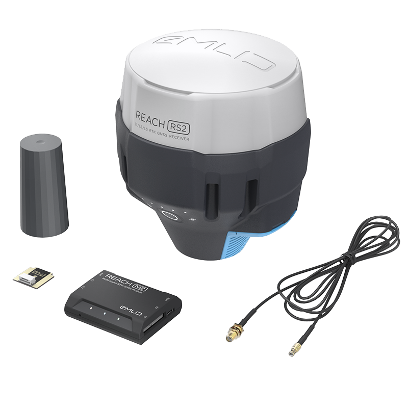
Emlid Reach M2 PPK UAV Mapping Kit – Dual Band

This package contains an Emlid Reach M2 multi-band GNSS receiver onboard the aircraft and a Reach RS2+ Base to enable centimeter level accuracy for your deliverables using the Aeromappers or VT-Naut in PPK mode (Post Processing Kinematic).

Available as a stand alone kit if you want to install to other drones, or delivered installed into an Aeromapper or VT Naut fixed wing drones.

The kit includes:

  • Reach RS2+ with case and strap
  • Reach M2 with Multi-band GNSS antenna
  • Reach M+/M2 SMA antenna adapter cable 0.5m
  • USB Type-C cable
  • Micro-USB cable
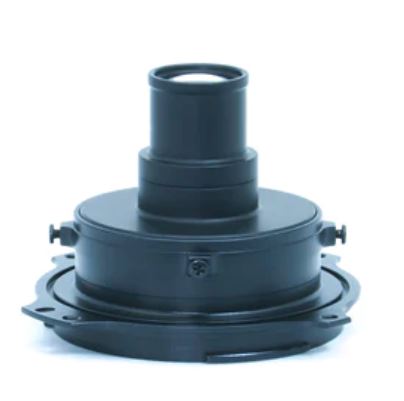
  • Includes hot shoe adapter

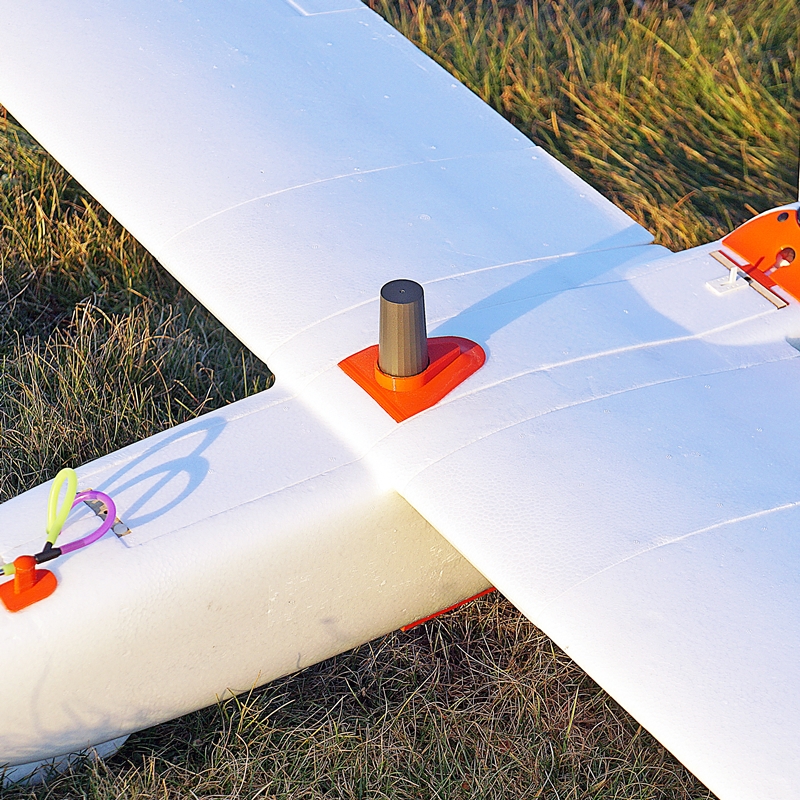
Reach connects directly to the camera hot shoe port, which is synced with the shutter. This solves the problem of positioning, as the time and coordinates of each photo are logged with a resolution of less than a microsecond.


Enable PPK for your drone: With Reach RS2+ base and Reach M2 onboard module

Centimeter-accurate positioning: For accurate aerial mapping with fewer GCPs

NTRIP and RTCM3: Supported protocols to send and receive corrections


Save your time and reach remote areas

Reach onboard a drone allows you to drastically cut the number of ground control points (GCPs) this simplifies the setup process on-site and accurately maps even remote areas.

Why camera synchronization is so important?

Usually, the autopilot triggers the camera and records the coordinate it has at that moment. When the drone is flying at 20 m/s and GPS works at 5 Hz, that means your autopilot will only have position readings every 4 m, which is not suitable for precise georeferencing. There is also always a delay between the trigger and the actual moment the photo is taken.

Reach eliminates the delay

Reach solves the problem of positioning by connecting directly to the camera hot shoe port, which is synced with the shutter. The time and coordinates of each photo are logged with a resolution of less than a microsecond. This method allows GCPs to only be used to check your accuracy.

You may also like…

  • Sony ILX-LR1 61 Mp drone mapping cameraSony ILX-LR1 61 Mp drone mapping camera $4,890.00 CAD Add to cart
    Sony ILX-LR1 61 Mp drone mapping camera
    $4,890.00 CAD

Related products

  • ADTi 61MP 61PRO Surveyor Drone Mapping CamerasADTi 61MP 61PRO Surveyor Drone Mapping Cameras $6,900.00 CAD Add to cart
    ADTi 61MP 61PRO Surveyor Drone Mapping Cameras
    $6,900.00 CAD
  • ZR10 2K 4Mp 30X Hybrid Zoom 10X Optical zoomZR10 2K 4Mp 30X Hybrid Zoom 10X Optical zoom $1,350.00 CAD Add to cart
    ZR10 2K 4Mp 30X Hybrid Zoom 10X Optical zoom
    $1,350.00 CAD
  • ADTi 40 mm Full Frame Professional Mapping Camera LensADTi 40 mm Full Frame Professional Mapping Camera Lens $650.00 CAD Add to cart
    ADTi 40 mm Full Frame Professional Mapping Camera Lens
    $650.00 CAD
WE SHIP WORLDWIDE!
Prices are in Canadian Dollars.


We accept all Major Credit Cards, International Wire Transfers, Cheques and Purchase Orders or email Transfers from Canadian institutions.

Read our Store Policy or contact us for questions.

Product categories
  • Emlid
  • Surveying accessories
  • Emlid Bundles
  • Fixed Wing Drones
  • Payloads & Accessories
  • Remote ID
  • DJI Drones
  • DJI Care Refresh
  • Software

UAV manufacturer and developer of the unmanned aerial vehicles for mapping, surveying, precision agriculture and remote sensing.

Support : 1-647–928–4747
Mon to Fri : 9:00am – 5:00pm
Email : info@aeromao.com

Latest News

  • Emlid Flow Localization feature and major updates September 18, 2023
  • DJI Mavic 3E with Reach RS2+ base June 7, 2023
  • Aeromao wins Bid to supply water-landing Aeromapper Talons to United Nations FAO Philippines December 29, 2022

Our Products

  • VT-NAUT
  • Payloads & Accessories
  • Emlid
  • Fixed Wing Drones
  • Software
  • Surveying accessories

Social Links

payment-methods

©2024 Aeromao Inc. All Rights Reserved.
Store Policy | Terms & Conditions