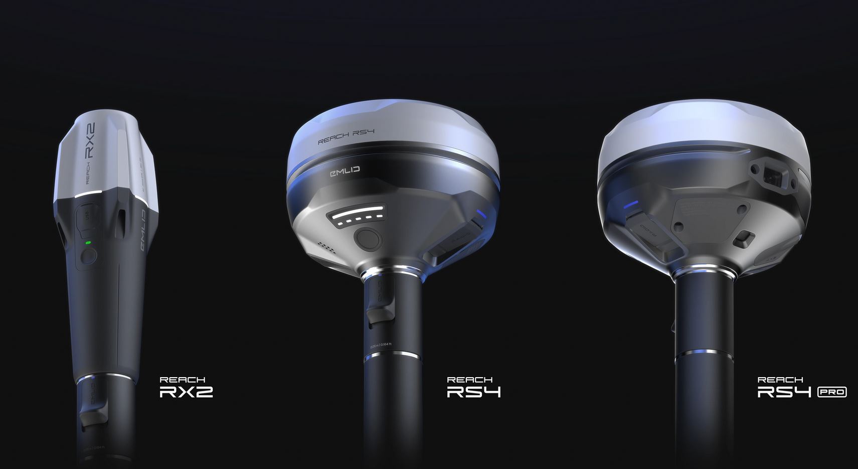
Emlid delivers professional RTK & PPK GNSS receivers built for accurate, reliable, centimeter-level positioning without the high cost. Over 20,000 users trust our precision RTK GNSS gear for surveying, construction, drone mapping, GIS, agriculture, and geophysics. The all-band Emlid Reach RS4 Pro adds dual cameras with AR stakeout and visual measurement, the rugged RS4 delivers tilt-compensated RTK in tough conditions, and the portable Reach RX2 offers lightweight, IP68-rated RTK performance with multi-constellation support. All work seamlessly with Emlid Flow software for field data collection and survey workflows.
Reach RS4 Pro
All-band RTK GNSS receiver with dual cameras and tilt compensation
Make any on-site workflow easier with AR stakeout, measuring from images, and high precision.

Reach RS4
All-band RTK GNSS receiver with tilt compensation. Ideal for everything from topo surveys to design set-out.

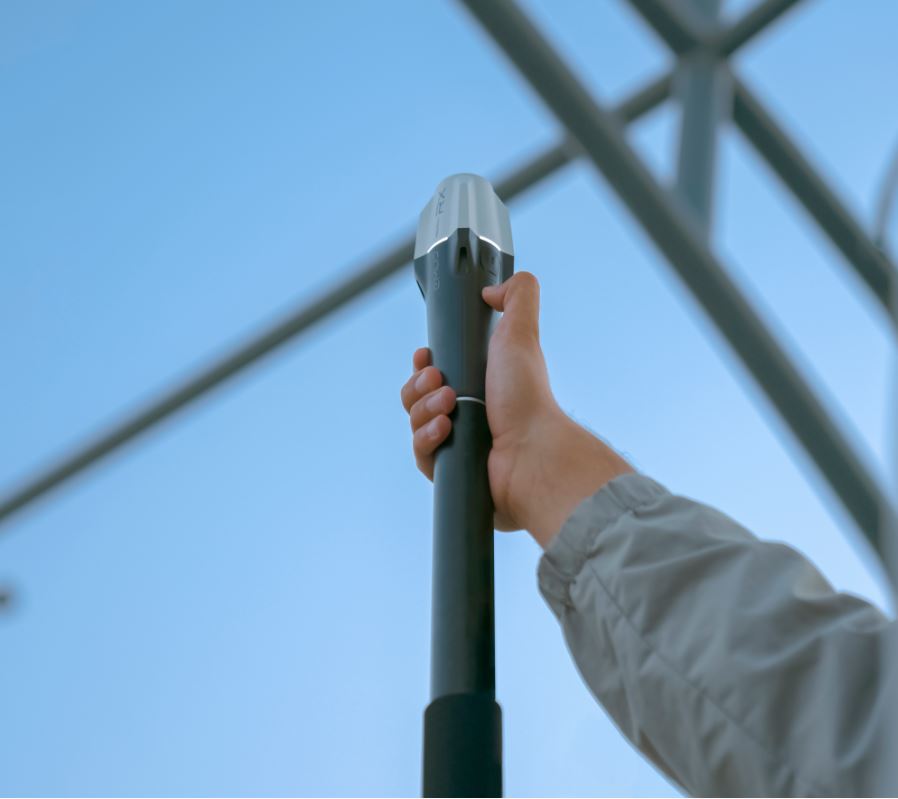
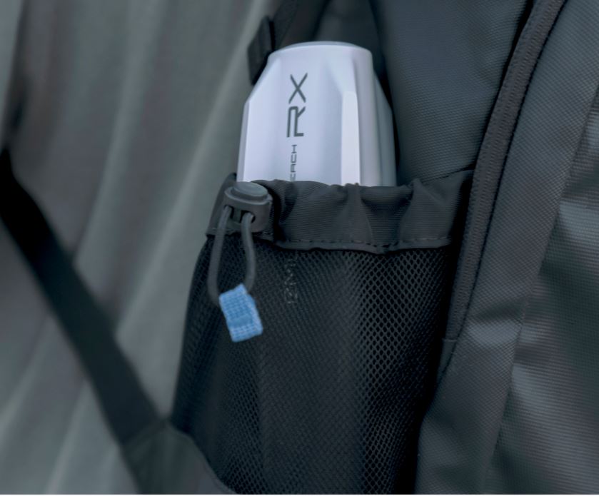
Reach RX2.
Ultralight RTK rover with tilt compensation for GIS mapping, design layout, and terrestrial scanning.

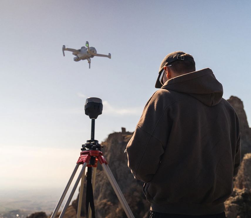
Drone-based surveying & mapping
Set up a base station and collect GCPs with Reach RS3
 Works online & offline
 Free GCP collection in Emlid Flow
 RTK & PPK drones
 Free PPK photo geotagging in Emlid Studio
Provides high precision for your UAV, regardless of cellular coverage or distance from urban areas. To collect ground control points, connect a second Reach RS3 or Reach RX2.

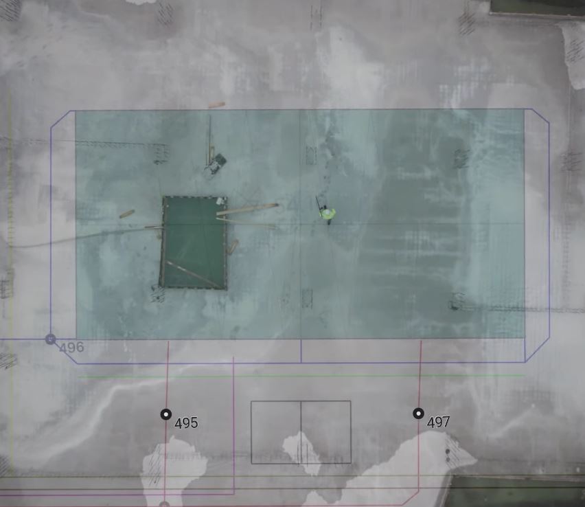
From topographic survey to design set-out
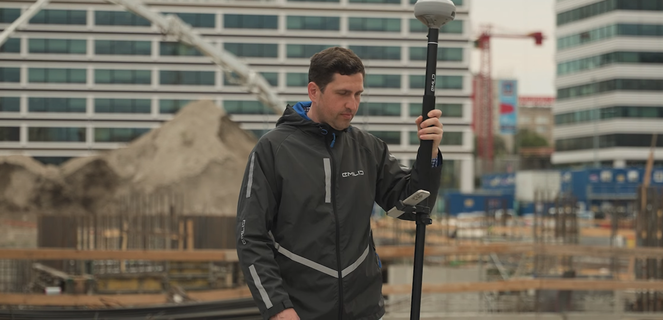
Reach RS4 Pro and Emlid Flow for accurate site work
Emlid Flow lets you work with CAD files and DTMs, collect and stake out points, calculate geometry, and ensure structures are positioned exactly to plan. With cloud-based Emlid Flow 360, your field and office always stay in sync.
Paired with Reach receivers, you get centimeter accuracy – even when tilted – and a battery that lasts all day, ensuring reliable performance in the field.
Survey codes / WMS / Inverse & Traverse / DTM / Stakeout reports / DXF, SHP, CSV / Auto Collection / Cloud sync
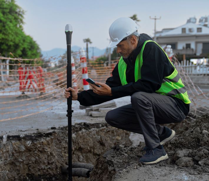
Centimeter-accurate GIS data
Improve geodata accuracy with Reach RX2
Compact receiver for collecting lots of data quickly, every day. Designed to deliver high accuracy even tilted. No need for extensive GPS and GNSS expertise.
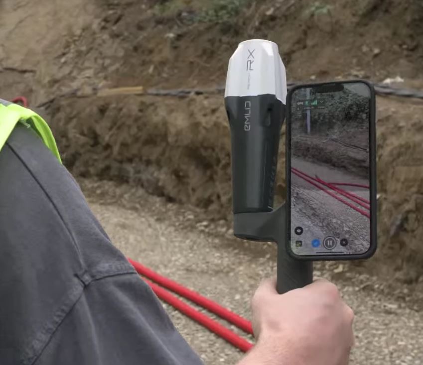
Mobile terrestrial scanning
smartphone and Reach RX2
Attached to a portable handle, Reach RX2 provides RTK accuracy and integrates with iPhone and Android scanning applications.
Pix4D & Emlid scanning kit
The ready-to-go solution: get high-precision coordinates from Reach RX2 and powerful photogrammetry from Pix4D.
Software for the field and the office
Emlid Flow
Emlid Caster
Emlid Studio
Reach RS4 Pro. Discover the new way to survey with dual cameras
REACH RS4 PRO
With the RS4 Pro, stakeout becomes visual. Rather than simply following coordinates on a map, your designs are directly overlaid on the real world, clearly showing where to place stakes.
- Dynamic navigation
- Auto bullseye View
- Cut & fill indicator
- Quick point switch
Crews can work faster with AR guidance, even on complex construction sites and roadworks.

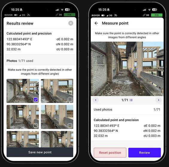
Measure from images
Even if you can’t put the pole there, you can still measure it with your RS4 Pro. Use the cameras to measure building facades, areas behind fences, across busy roads and any other inaccessible points.
Save time setting up a total station and avoid hazardous areas.
Across water/Behind fences/Over traffic/Above pits/Past hedges/Around machinery
Unmatched precision, even under canopy
The Reach RS4 Pro delivers centimeter-level accuracy, even in challenging environments like forests or urban canyons. With support for every GNSS constellation and signal frequency, including the L5 and L6 bands, resistant to multipath and interference, the Reach RS4 Pro locks onto 40+ satellites simultaneously using 672 channels.
- 7mm + 1 ppm in RTK

- GPS, GLONASS, Galileo, BeiDou, QZSS, NavIC
- Fix in under 5 seconds
- 672 channels
- Full-band support: L1 / L2 / L5 / L6

Next-gen tilt compensation
The advanced tilt compensation stays accurate even at steep angles. For example, at a 30° tilt, the Reach RS4 Pro still delivers 18 mm precision.1 Initialization takes just a few quick movements and remains stable throughout the job—no manual recalibration needed.
- Factory-calibrated
-
Rapid initialization
- Interference-proof
- Unlimited tilt angles
Quick release mount
The custom-designed quick release mount ensures the receiver is locked firmly to your survey pole, eliminating backlash. Even the smallest wobble can affect tilt-based measurements at steeper angles. This mount solves the issue with a fast and rock-solid connection for reliable data accuracy.

Base and rover connectivity
NTRIP
Connect to VRS or single-base CORS networks using RTCM3 format for precise RTK corrections. You can also transmit corrections from your own base using Emlid NTRIP Caster
Dual-band radio
UHF 450 MHz
- Transmit and receive
- Up to 2W ( may require a license2 )
- Compatible with Reach and 3rd-party receivers with TRIMTALK 450S support3
LoRa 915 MHz
- Transmit and receive
- Up to 1W ( license-free in North America2 )
- Compatible with Reach receivers
Engineered for the harshest environments
Magnesium alloy body
Crafted from the same material used in aerospace and high-end tech, the Reach RS4 Pro magnesium body offers exceptional strength without the extra weight. It’s rugged enough for demanding job sites—and light enough for all-day use.
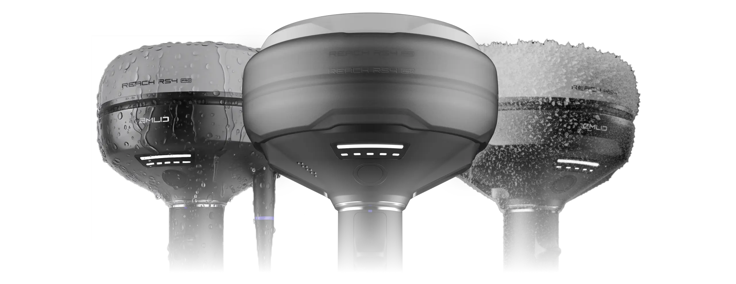
Waterproof
From rainstorms to dusty construction sites, the Reach RS4 Pro is fully ready. With an IP68 rating, it’s completely sealed against water and debris.
16 hours on one charge
No need to stop mid-job to recharge. The Reach RS4 Pro runs up to 16 hours on a single charge. Power up via USB-C or plug in a power bank on the go—maximum uptime, minimum hassle.

-40 to +65 ºС
From cold to heat, the Reach RS4 Pro performs without compromise. Engineered to operate flawlessly between -40°C and +65°C, it’s ready for work anywhere.
End
Emlid Reach RS4.
The Reach RS4 can track all available satellite constellations and frequencies, including the lower L5 and L6 bands, which are more resistant to multipath and interference. With 672 channels, it can track 40+ satellites at a time. These features ensure reliable performance and centimeter-level precision
- 672 channels
- Fix in less than 5 seconds

Next-gen tilt compensation
The Reach RS4 delivers accurate results even at high tilt angles — for example, a 30° tilt still achieves 18 mm precision.1 The compensation mechanism activates with just a few moves and remains stable throughout the survey, saving time and avoiding the need for recalibration.
- Factory-calibrated
- Faster initialization
- Immune to interference
-
No angle limit
Quick release mount
This mount is specifically designed for tilt compensation, eliminating backlash and securing the receiver firmly to the survey pole. Even a small amount of wobble between the device and the pole can compromise the accuracy when tilting. The quick-release system provides a fast and reliable connection for maximum precision.
Base and rover
NTRIP
Work in RTK with VRS or a single baseline CORS network in RTCM3 format. You can also connect another GNSS receiver as an NTRIP base using Emlid NTRIP Caster
Dual-band radio
UHF 450 MHz
- Transmit and receive
- Up to 2W ( may require a license2 )
- Compatible with Reach and 3rd-party receivers with TRIMTALK 450S support3
LoRa 915 MHz
- Transmit and receive
- Up to 1W ( license-free in North America2 )
- Compatible with Reach receivers
Built to perform in extreme conditions
Magnesium alloy body
The RS4’s magnesium alloy body is as strong as it is lightweight. This material is often used for aerospace equipment and high-end electronics. It strikes the perfect balance of durability and lightness, making it ideal for use in tough conditions while remaining easy to handle.
Waterproof
Thanks to its IP68 rating, the RS4 is fully dustproof and waterproof. Whether it’s raining, snowing or a dusty construction site, the Reach RS4 will keep working.
16 hours on one charge
The RS4 offers an impressive battery life of up to 16 hours on a single charge. Use the USB-C for recharging or use a power bank for even greater flexibility. Designed to keep working as hard as you do, without interruption.
-40 to +65 ºС
The Reach RS4 operates in temperatures from -40°C to +65°C. Its performance remains excellent in both freezing cold and scorching heat.
End
Mapping with Reach RX2.
Fast and precise in any landscape
The RX2 maintains centimeter accuracy even at high tilt angles. Perfect for measuring near walls, slopes, or tight spaces without leveling the pole.
Quick release mount
Designed to secure the RX2 to a pole quickly and without any backlash.
No setup required
Tilt compensation is on after just a short walk. No extra steps or calibration.

Fits your workflow
Ready for data collection and design layout
Every RX2 comes with Emlid Flow, our user-friendly app for iOS and Android that assists with a variety of field tasks in areas such as construction, utilities, GIS and landscaping.
All your data is instantly synced to the cloud, meaning your office team always has the latest updates.
Construction/Utilities/Landscaping
Compatible with Esri and other GIS apps
Integrate high-accuracy GPS data into your familiar workflow. This is perfect for local and state governments, urban planning, digital twins, water management, nature conservation, and much more besides.
With Apple MFi certification, RX2 connects natively and reliably to iPhones and iPads. It also works seamlessly with Android devices.
RX2 supports all popular data collection apps, including ArcGIS Field Maps, QField, Survey123, Mergin Maps, and more.
Terrestrial scanning with centimeter precision
RX2 supports terrestrial scanning with high accuracy — just mount it on a handle and pair it with a scanning app like PIX4Dcatch.
Capture precise 3D models of vertical surfaces and hard-to-reach areas for utility mapping, volume calculations, and as-built documentation.

End
Emlid Flow
The Reach Receivers are powered by Emlid Flow—a complete field and cloud solution for iOS
and Android. From initial setup to final verification, Emlid Flow keeps your entire team
connected, your data synchronized, and your project on track.
- Invite team members, share project data and settings
- Monitor field progress from the office and sync data instantly with the field
- Unified workflows for all team members, consistent interface, no extra training needed
- Topographic surveys: capture precise elevation and terrain data
- Line & road surveys – stake centerlines and offsets with precision
- As-builts: confirm construction accuracy against design plans
- Stakeout & layout: mark points, lines, and site boundaries
- Cut & fill calculations: measure stockpiles and earthworks on-site
Compact phone for the field,
big screen for the office
Emlid Flow 360
Any browser
- Prepare and manage projects
- Instantly share data between field and office
- Always have a backup of your work
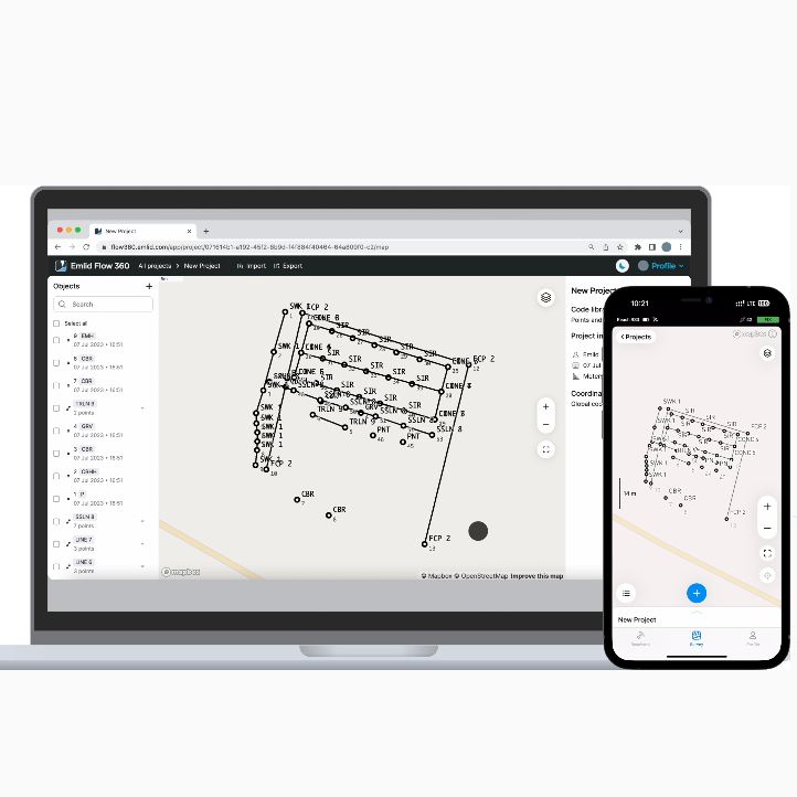
Emlid Flow
iOS, Android
- Configure and manage
- Reach devices
- Set up base and rover Log raw data for post-processing
- Survey in the field
All covered
Smart tools from data collection to editing. Whether your project includes thousands of points or just a few, our easy-to-use survey app ensures everything works quickly and does not clutter up the map.
We collected and verified all the projections, grids, and geoids for various parts of the world that we could find. If yours is not on the list, contact us or add it yourself.
Advanced methods for working with coordinate systems. Ideal for cases where you need to offset your survey data, or when parameters are outdated or unknown.
The tools that make land surveys and property analysis easier. Take designs into the field, create geometry on the go, and review data online for informed decision-making.
Walk, drive, bike or sail while the app automatically collects data for you, making your land survey tasks simpler than ever.
Choose your version
A single plan for Emlid Flow and
Emlid Flow 360.
FREE
FREE
Ideal for individuals or small teams
Receiver configuration
Export & Import: CSV, DXF, SHP, KML
Collect and stakeout points
Coordinate systems and base shift tool
Configure precision for collect
Satellite and vector maps
Unlimited projects with instant sync
Collaboration tools:
Up to 10 team members
Team workspace for shared data and presets
Data authorship
PRO
PRO
For growing teams managing complex projects with advanced tools.
Everything from Free
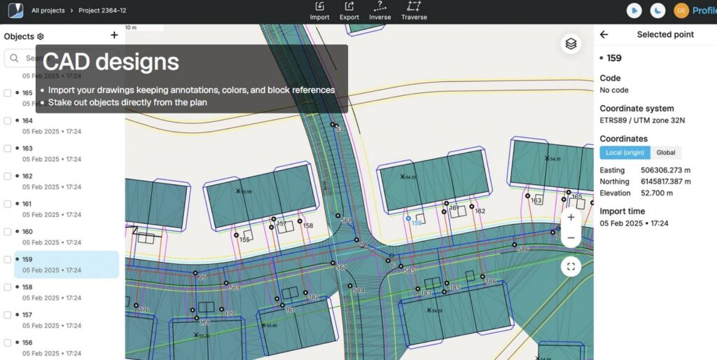
Work with CAD and DTM files
Localization and COGO tools
Linework with 4 stakeout modes
Code libraries
Reports, auto collection, and more
File storage: 10 GB per user
Collaboration tools:
Unlimited team members
Team workspace for shared data and presets
Data authorship


End
Emlid Reach RS3.
RTK GNSS receiver with tilt compensation
Survey grade precision, even in hard-to-reach spots
Multi-band base and rover
IMU tilt compensation
LTE modem
Dual-band radio

Accurate results even with large tilt angles
The IMU-based tilt compensation in Reach RS3 enables you to make measurements with up to 60 degrees of tilt while still staying within 20 mm of accuracy.
Reach RS3 continuously measures and corrects tilt in real-time to keep you on target.

Survey and stakeout faster
No need to check the bubble
Effortless and robust
Tilt compensation
Calibration-free
We calibrate each unit individually at the factory, so you can get your Reach RS3 up and running right out of the box.
Immune to magnetic disturbances
Unaffected by magnetic fields, the RS3 provides robust tilt compensation even when working close to metal structures.
Quick initialization
Tilt initialization takes about 20 meters of walking or 10-20 seconds of tilting. Usually ready on the way from the car.
Rapid and Reliable GNSS receiver
Gets a fix in 5 seconds
Reach RS3 gets a centimeter-accurate solution in about 5 seconds. It maintains robust performance even when the sky view is partially obstructed, or the receiver itself is tilted.
GPS/QZSS, GLONASS, BeiDou, and Galileo
L1C/A, L2C, L1OF, L2OF, B1I, B2I, E1B/C, E5b
RINEX logging and PPP support
Record raw data in the RINEX format for post-processing. You can use free PPK software, Emlid Studio, or any other software that supports RINEX. Logs are also compatible with OPUS, AUSPOS, and PPP services, so you can get highly accurate results anywhere in the world.
16 GB storage
160+ days of logging at 1 Hz
Up to 22 hours on 1 charge
Reach RS3 comes equipped with a built-in, industrial-grade battery that can endure up to 22 hours of logging or 18 hours of working with tilt in RTK.
For uninterrupted multi-day operation, simply connect a power bank, just like you would with your mobile phone.
Charging via USB-C
Built-in LTE modem
Insert a SIM card into your Reach RS3 and let it broadcast or receive corrections via NTRIP.
Get corrections from CORS, Reach, or 3rd-party base
NTRIP
Base and Rover
Work in RTK with VRS or a single baseline CORS network. You can also connect another GNSS receiver as an NTRIP base using Emlid NTRIP Caster.
Compatibility
Any receiver with RTCM3 support
Dual-band radio
LoRa 868/915 MHz
Base and Rover
Perfect for areas with no internet coverage for NTRIP. LoRa is used when connecting Emlid receivers over the radio.
Compatibility
All Emlid receivers with built-in radios
UHF 450 MHz
Rover
An option to mix and match RTK receivers within your fleet. You can configure your Reach RS3 to receive corrections from an existing base.
You can also use a high-power external radio on your Reach base and connect with the UHF radio receiver in Reach RS3.
Compatibility
Bases with radios that transmit TRIMTALK 450S
*TRIMTALK is a trademark of Trimble Inc.
Emlid Flow
Emlid Flow efficiently manages all field-related tasks, including receiver configuration, RINEX logging, data collection, and stakeout.
For iOS and Android. The basic features are available for free to all users. Upgrade your Emlid Flow and Flow 360 with a single subscription.
- Tilt Compensation
- Data collection and stakeout
- Localization
- Coding
- Logging
- Background maps
- Base and rover setup
- Sync up to 3 devices
- Base shift
- CSV, DXF, SHP export and import
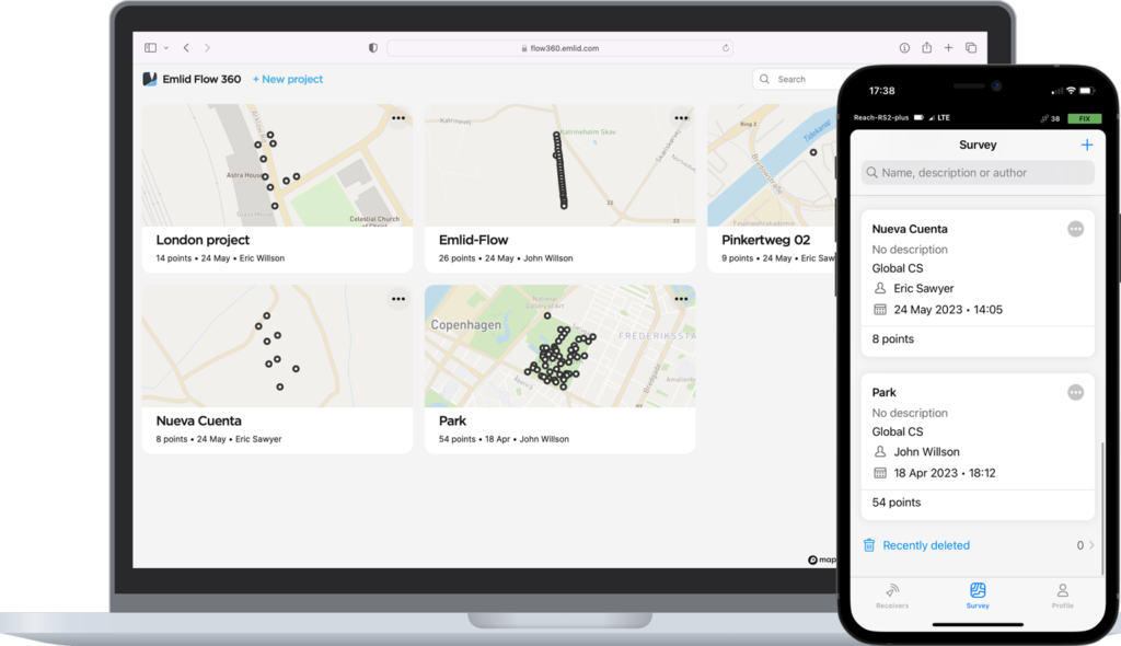
Emlid Flow 360
You can access your survey data via the cloud-based Emlid Flow 360, which allows you to prepare, manage, and export your projects from a browser.
The basic features are available for free to all users. Upgrade your Emlid Flow and Flow 360 with a single subscription.
- Add WMS/WMTS layers
- Satellite map
- Create custom survey codes libraries
- Export and import of survey data
- Project management and sync
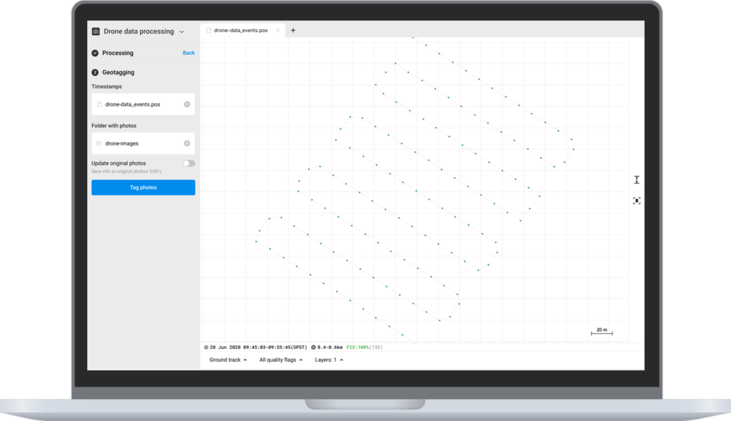
Emlid Studio
Free post-processing software for macOS and Windows.
Learn more about Emlid Studio here.
- Kinematic processing
- Static processing
- RTK Drone data processing
- Raw data analysis
- Stop & Go with Emlid Flow
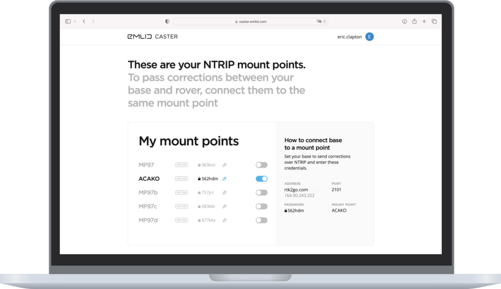
Emlid Caster
Connect up to 10 rovers to your base station via the internet or set up your own NTRIP network with Emlid Caster.
Learn more about Emlid Caster here.
- Available for free and works worldwide
- Works with Reach and other receivers with NTRIP support
- RTCM3 and other correction formats support
- Up to 5 bases and 10 rovers at the same time
Emlid support
Tutorials
Watch quickstart guides and comprehensive feature overviews.
Emlid support team regularly updates all materials based on the most frequently asked questions and popular workflows.
Lifetime support
To get help with general questions and configuration, contact application engineers via E-mail.
Community
Join the Forum to get in touch with the Emlid team, get tips and advice, and connect with Emlid users from around the world.
Emlid Reach RX
Network RTK rover with centimeter accuracy Pocket-sized and lightweight receiver.
Works with NTRIP corrections.
When paired with the signature Emlid survey-pole, the Reach RX becomes the most simple measurement/locating tool on the job site. Centimeter-level accuracy that is fast, light, and so incredibly useful.
It is just that: the usability and the ease of use, that raises the level of productivity, for both skilled professionals and laypeople.
")
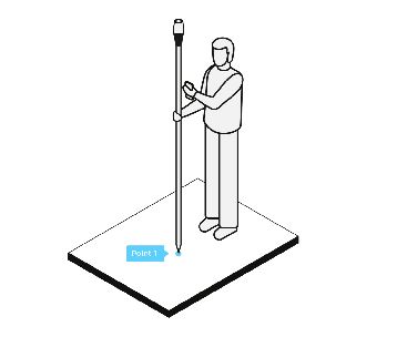
Get started in 1 minute
Install the ReachView app now and take a few moments to get familiar: [Android app – free], [iOS app – free].
Then, after unpacking your new Reach RX, you can be collecting your first point in 60 seconds.
Easy to set up:
just add NTRIP. Reach RX uses Bluetooth, allowing you to connect and start surveying in a few seconds. No settings to get wrong.
1. Enable Bluetooth on your device and find your Reach RX in ReachView 3.
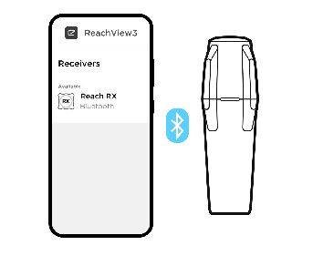
2. Add network correction credentials
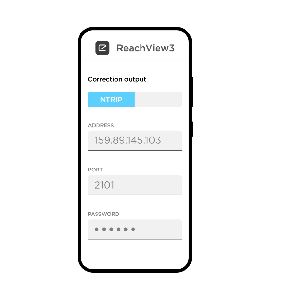
3. Collect your first point.
AVAILABLE AS A: Network Base and Rover kit Reach RX Kit Reach RX Team kit
Reach RX is a network-rover
Reach RX uses the Bluetooth LE connection to your phone/tablet to receive a feed from the Internet, via an NTRIP[?] caster, so you’ll need some NTRIP credentials.
But don’t worry if you don’t have NTRIP credentials at the moment, because you could
- A) use a Reach RS2+ as your base-station, employing Emlid’s easy NTRIP casterfor the task; or
- B) pick up some NTRIP credentials from a local, government, or large-network NTRIP provider [extensive list].
- C) and operate their own NTRIP caster, e.g. using source code from GitHub.] (For advanced users)
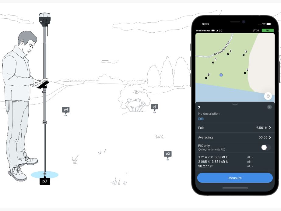
Accomplish your basic surveying goals with the ReachView 3 app
Import and export points from ReachView 3 in various formats, such as Shapefile, DXF, and CSV.
Whether you collect, then export the points; or import, then stake-out the points; or just do everything you need within ReachView, you are assured of a simple process with universal options for moving your data in and out.
You could use your favorite third-party surveying/GIS app as well. There are techniques to make your device get its location from Reach RX, which allows any app to work with the accuracy of Reach RX. Some third-party apps will be able to work directly with Reach RX as well.
UAV MAPPING WITHOUT GCPs
Positioning with centimeter accuracy in RTK and PPK. For precise UAV mapping with less GCPs.
Reach provides very accurate positioning by connecting directly to the camera hot shoe port, which is synced with the shutter. The time and coordinates of each photo are logged with a resolution of less than a microsecond. This method allows GCPs to be used only to check your accuracy.
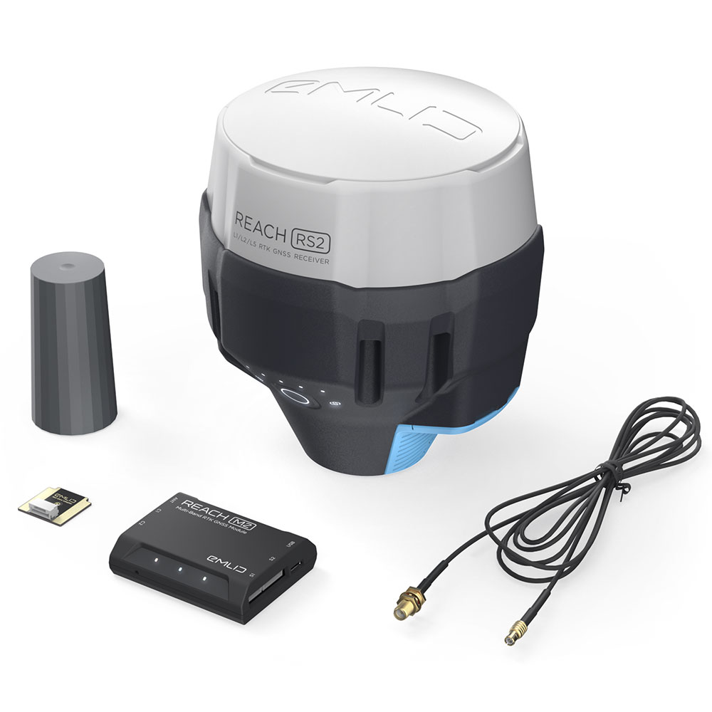
REACH M2
Multi-band
Baseline up to 100 km in PPK

![]() Compatible with Aeromappers fixed wing drones
Compatible with Aeromappers fixed wing drones
![]() Swappable with all other Aeromapper payloads
Swappable with all other Aeromapper payloads
![]() Also available as stand alone modules or full mapping kits
Also available as stand alone modules or full mapping kits
COMPLETE UAV MAPPING KITS (PPK)
Add to your Aeromappers, for the ultimate toolbox for Professional Surveying with no GCPs
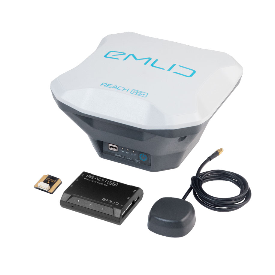
Reach M+ PPK UAV mapping kit Single Band
Reach M+, Reach RS+, GNSS antenna Ready to use with the Aeromapper of choice.
Reach M2 PPK UAV mapping kit Multiband
Reach M2, Reach RS2 and GNSS antenna Ready to use with the Aeromapper of choice.