Accurate position information has become vital in construction, mining, farming, infrastructure, and environmental industries. Time schedules are getting shorter, projects are getting bigger, and, to be honest, old surveying procedures are no longer effective. That is why a UAV drone has become the preferred instrument for professional survey work.
At Aeromao Inc., we have seen how drone technology has radically revolutionized the way corporations manage survey data. But there isn’t a drone solution that works for everyone. There are numerous varieties, including fixed wing and multirotor models, along with different sensors, flight durations, and levels of accuracy. The results of your project and the effectiveness of your team will suffer if you make the incorrect decision.
There is a purpose for this guide. Should you have an interest in drones or should you want to improve the drones that you have, you need to know some things prior to purchasing. Here are several things that you should be aware of regarding surveying drones, their features, and potential mistakes.
What Is a UAV Drone and What Is Its Role for Surveyors?
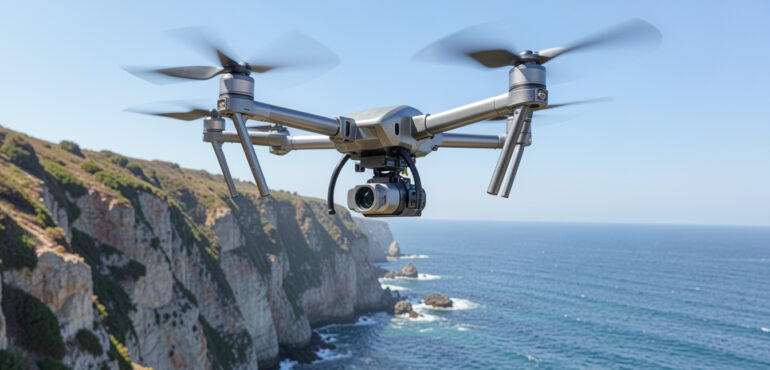
Unmanned aerial vehicles, or UAVs, are aircraft that fly without a pilot. A UAV drone comes equipped with cameras and GPS, as well as software, hence the capability of collecting massive amounts of information quickly.
Drones eliminate the need for surveyors to spend their days walking through large sites and taking measurements on the ground. Alternatively, you can use digital terrain and elevation models, orthomosaics, aerial photos, and a plethora of other data to map out locations in depth.
The real draw? Three things: speed, accuracy, and safety. Work that would have taken days can now be completed in a matter of hours. RTK and PPK positioning technologies reduce the number of ground control points you need to specify while increasing accuracy. Drones can even reach hazardous or challenging locations that humans cannot. Therefore, companies rely on it when they want to get more done faster while remaining confident that the data is reliable.
Interested in fixed wing systems for mapping? Read this detailed guide, “The Complete Guide to Fixed Wing Drones for Surveying and Mapping.” This topic will address flight time and why fixed wing UAVs are preferable for mapping out a wide expanse of space.
Important Things to Consider Before Buying a UAV Drone
Not all drones are useful for survey purposes. Despite drones being alike in appearance, there are vast differences between the capabilities of different drones. The following are some important factors to consider when purchasing a UAV drone.
Flight Time and Coverage Area
To begin with, consider how long the aircraft can remain in the air. More coverage capability is attained as flight duration increases. Endurance is crucial for larger-scale tasks, including mine exploration, forestry activities, pipeline inspection, and field mapping. Generally, fixed wing UAVs have greater endurance compared to multirotors.
Positioning Accuracy
Good data drives every successful survey. Drones with RTK or PPK tech give you that next-level positioning accuracy, so you get sharper maps and fewer errors. When you’re weighing your options, check their geospatial specs closely. Better accuracy doesn’t just look good on paper; it means fewer headaches and less time spent in the field.
Sensor Compatibility
Every project asks for something different. For one purpose, standard photos might be adequate, but thermal imaging, multispectral sensors, or even full LiDAR scans might be necessary for another. You want a UAV drone that plays well with different sensors, now and in the future. Here, flexibility extends your investment and keeps you prepared for any eventuality.
Ease of Operation
Field work isn’t always predictable. If a drone is complicated to operate, you waste precious daylight trying to get things set up. Look for user-friendly controls, straightforward mission planning, and smart automation. The easier it is to launch and manage, the smoother your day goes and the better your results.
Durability and Reliability
Out in the field, conditions shift fast. Temperatures fluctuate, wind increases, and dust and moisture spread everywhere. A survey-grade UAV drone needs to hold up to tough environments and keep flying. Robust construction and trustworthy flight systems help you avoid downtime and give you more confidence when the weather turns.
Regulatory Requirements
Don’t forget the rules. Before deciding which drone to buy, find out more about your regulations, flight authorizations, certification requirements, and BVLOS (Beyond Visual Line of Sight) capabilities in the area. This will help you prevent any compliance issues down the line.
Fixed Wing vs. Multirotor UAV Drones: Which Is Better for Survey Operations?
In choosing a drone for any survey project, one must consider whether to choose a fixed wing or multirotor model since each type has its unique advantages.
Fixed wing UAV Drone
Fixed wing UAVs are able to cover a lot of ground in a single mission and remain in the air for longer. These UAVs use wing lift, making them efficient in energy usage. Fixed wing drones are good for covering large sites such as mining surveys, farm mapping, utility corridors, and environmental monitoring.
Multirotor UAV Drone
As multirotor UAVs can take off and land vertically, they are more practical for surveyors who need to work in small regions or do inspections over a single area. Multirotors offer manoeuvrability to capture accurate information over complex terrain.
Choosing Based on Project Needs
Since every drone model has pros and cons, it is crucial to realize that there is no one-size-fits-all method for choosing which drone to employ for surveys. However, if a project requires aerial mapping over large surfaces and long-distance flying, the optimal solution would be using a fixed wing UAV. Conversely, multirotors are more suitable for inspection tasks in constrained environments and small sites.
Common Mistakes to Avoid When Selecting a UAV Drone
Picking a UAV drone isn’t just about today; it’s really a long-term move. Still, we see plenty of organizations get caught up in quick wins and lose sight of what’s coming down the road.
- Obsessing Over Price
Let’s be honest, focusing just on price is a huge pitfall. Sure, everyone has a budget, but grabbing the cheapest drone often means you’re missing real surveying power. Later on, that causes headaches and additional expenses.
- Skipping Over Data Accuracy
People also sometimes forget about data accuracy. Fancy images are nice, but if the drone can’t pin down precise positioning, the whole project falls short.
- Ignoring Software Compatibility
Another one, software compatibility. The UAV drone you select should integrate well with the tools, data systems, and workflows you already have. If it doesn’t, you’re creating hassles that only slow things down.
- No Plan for Growth
The possibility that one’s needs could alter is frequently disregarded. There may be more sensors, more flight hours, and more advanced capabilities needed as the scale of the project grows and becomes more sophisticated. It pays off to invest in a system that is scalable.
At Aeromao Inc., we consistently advise businesses to consider both their immediate needs and potential future needs. This mindset keeps your UAV drone effective, even as your goals shift.
Conclusion
Selecting an appropriate UAV drone does not necessarily depend on whether all specifications have been checked. The most important items to consider when making a selection are the amount of the area covered, the level of accuracy necessary, the type of sensors, environmental conditions, and applicable legislation.
Look closely at the critical features. Avoid common pitfalls, don’t let price alone lead your decision, and definitely don’t ignore how well the system fits into your workflow or adapts to bigger jobs ahead. A thought-out drone investment is one you’ll keep relying on for years.
At Aeromao Inc., we’ve worked with organizations of all sizes, helping them match drone platforms to their actual survey needs. Projects have their unique problems, but through our expertise in mapping, remote sensing, aerial surveys, and field surveys, we can assist you in solving any of your projects.
For those who are interested in using drones for surveys, get in touch with Aeromao Inc. for further information.
FAQs
What’s the best UAV drone for professional surveying?
Honestly, there’s no single answer. It depends entirely on what you need for your project. You have to think about the size of the area you’re surveying, how precise you want the data, how long the drone needs to stay in the air, which sensors you need it to carry, and even what kind of weather or environment you’ll be working in.
Why do people use UAV drones in surveying?
Surveyors turn to UAV drones because they grab accurate aerial data way faster than traditional methods. Drones make the whole process more efficient, let you cover more ground, and cut down on how much fieldwork you actually need to do.
What’s different between fixed wing and multirotor survey drones?
Fixed wing drones go longer and cover more ground, which is great for big sites. Multirotor drones, on the other hand, take off and land vertically and are much better when space is tight or when you need agile movements.
Do you need RTK or PPK technology for survey drones?
RTK and PPK definitely boost your location accuracy and cut down on the need for tons of ground control points. Still, not every job calls for them. Sometimes you can get what you need without these added systems.
How accurate are UAV drones for surveying?
If you’ve got a solid drone setup, a good positioning system, and a proper workflow, you can hit centimetre-level accuracy. So, with the right tech, drones are incredibly precise.
What sensors work with survey drones?
You have lots of options depending on what you’re surveying. With RGB cameras, thermal sensors, multispectral cameras, and LiDAR, you can mix and match based on your platform and what kind of data you need for mapping or inspections.
How do I choose the right UAV drone for my project?
First of all, think about your survey objectives. How much area do you need to cover? What level of accuracy will you require? Will you need to use sensors? What are the environmental conditions? And, of course, you must consider regulatory obligations. Reflecting on these points will help you find the most appropriate solution.