Have you ever wondered how construction sites, farms, forests, mines, and other similar areas are quickly and precisely mapped these days? Often, the answer is UAV mapping. Within the last couple of years, UAV mapping has become one of the most effective methods of gathering and analyzing geographic data. What usually took days or even weeks when done traditionally can be achieved within minutes by employing drone technology.
At Aeromao Inc., we assist enterprises that need accurate information for their surveying, inspection, environmental monitoring, and mapping activities. As UAV technologies gain popularity among the public, more and more individuals who are just getting acquainted with drones want to learn how UAV mapping operates, its benefits, and possible applications.
Thus, this guide will attempt to provide answers to all these questions in a clear and understandable manner. For surveyors who wish to explore novel means of gathering data, business owners looking for efficient mapping solutions, or enthusiasts of drone-based technologies, the current article will offer valuable information.
What Is UAV Mapping?
UAV mapping uses drones, yeah, those Unmanned Aerial Vehicles, to snap aerial photos and gather location data. Then, you transform that information into exact maps, 3D models, and survey-grade results. It’s a significant improvement over traditional surveying, which requires measuring everything on the ground.
Drones handle the heavy lifting from above, covering a ton of space fast. They fly a pre-set course, snapping overlapping images that you process through specialist software afterward. This approach gives professionals detailed geographic info fast, with less hassle and fewer hours out in the field.
You’ll see UAV mapping everywhere these days: construction, farming, mining, environmental work, and land surveys. It’s popular because you get faster turnaround and broader coverage without losing accuracy.
How Does UAV Mapping Work?
Everything kicks off with careful planning. Operators mark out the survey area and build an automated flight path so the drone hits every spot and grabs overlapping images. Once the drone’s up, it fires off high-res photos, and systems like GPS, RTK, or PPK lock down the locations for each shot.
When the flight’s done, you load all those images into photogrammetry software. The software analyzes the photographs, locates related points, and combines everything into precise mapping output.
Depending on what the project calls for, the results can be orthomosaic maps, digital elevation models, point clouds, contour maps, or full 3D models. This approach is rapid and accurate and far more efficient than most standard surveying techniques.
Key Components of a UAV Mapping System
If you really want to understand UAV mapping, you need to know what goes into it; each technology plays a part.
-
UAV Platform
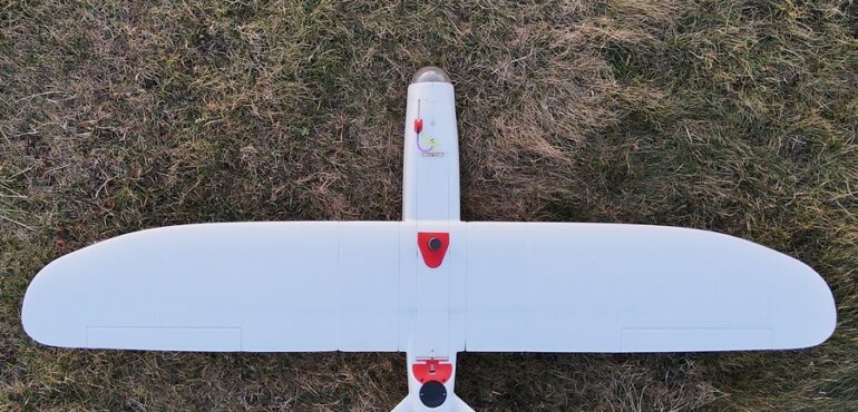
The drone acts as your mobile data collector. The type you pick depends on the job. Multirotor drones are ideal for tiny areas because they can simply lift off and land anywhere. But, if you’ve got a big site to map, fixed-wing UAVs are the way to go. They cover more ground in one trip and survive longer in the air. That’s why Aeromao Inc. focuses on fixed-wing mapping solutions for professional surveying and geospatial work.
-
Mapping Sensors
The sensor does the heavy lifting with data collection. You’ll find RGB cameras used all the time for crisp aerial maps or inspecting sites visually. Need to spot temperature differences? Thermal sensors handle it. Multispectral sensors are big in ag and environmental projects. If you need super-accurate elevation data, there’s LiDAR. The sensor you choose hinges on what information you’re after.
-
Positioning Technology
You can’t do reliable mapping without pinpoint accuracy. Most modern UAV systems employ GPS, but they frequently combine it with RTK (Real-Time Kinematic) or PPK (Post-Processed Kinematic) technology. That combo bumps up positional precision and delivers survey-grade results without needing loads of ground markers.
-
Data Processing Software
This is where everything comes together. Photogrammetry software converts the raw photographs your UAV acquires into practical mapping deliverables. Without this step, you’re just left with a stack of photos, not usable maps or measurements.
Put all of this together, UAVs, sensors, positioning, and software, and you’ve got a full-fledged mapping system that delivers consistent, reliable results.
Types of Data Produced Through UAV Mapping
UAV mapping stands out in so many businesses because it produces such a diverse set of results.
-
Orthomosaic Maps
Orthomosaic maps are probably the most common result of UAV mapping. There’s a reason for that: they stitch together hundreds of overlapping photos into one sharp, high-resolution image that truly reflects the area you surveyed. Since the process corrects geometric distortions, you can actually take accurate measurements right from the map. Surveyors, planners, and engineers lean on these maps for site analysis and planning.
-
Digital Elevation Models
A Digital Elevation Model, or DEM, gives you the height and shape of the terrain below. These models let professionals study slopes and drainage patterns, calculate earthwork volumes, and better understand landforms. They are widely utilized in environmental research, mining, and construction.
-
3D Models
The three-dimensional modelling goes even further, allowing for realistic presentations of objects and landscapes. The users can see all perspectives, analyze the structure, and easily present all necessary information to others involved in the project.
-
Point Clouds
Point clouds are massive sets of data points, sometimes millions, captured across a surface. They really pack in the details, making them perfect for engineering analysis, tricky volume calculations, and advanced surveying projects.
Benefits of UAV Mapping
UAV mapping is catching on fast, and for good reason. It’s hard to beat the speed; you can cover areas in a few hours that would take days on the ground. That kind of turnaround keeps projects on track and teams focused.
Accuracy stands out, too. Pair a UAV with RTK or PPK, and you get super precise results, good enough for even the most demanding professional jobs. And let’s not forget the savings. You don’t need huge teams in the field, and you wrap things up faster, which means lower operational costs.
Safety’s a big selling point as well. Rather than using humans for going underground into the mine or up a very steep hill, you could use a drone for collecting data without putting anybody at risk. Not only that, but the drones offer high-resolution visuals, ensuring that the decision-makers have all the information required to make the correct decisions.
Common Applications of UAV Mapping
The beauty of UAV mapping is how flexible it is. Land surveyors use drones to grab accurate topography data in no time. That info feeds into all sorts of projects, planning, design, and land development.
Construction folks use UAVs to keep tabs on progress, check volumes, and see how actual conditions stack up against the plans. Regular aerial surveys mean fewer surprises and smoother project management.
In mining, drones are becoming indispensable for measuring stockpiles, analyzing terrain, and general site monitoring. Large areas? No problem. Agriculture’s another success story. Farmers and agronomists fly drones to track crop health, spot problem patches, and manage resources more efficiently.
Environmental groups lean on UAV mapping for habitat assessments, forestry management, and conservation. The accuracy here helps researchers track real changes in the landscape. And when it comes to infrastructure, think roads, pipelines, and power lines; drone mapping is making inspections faster and more detailed than traditional methods.
Fixed-Wing vs. Multirotor UAVs for Mapping
People often ask whether fixed-wing or multirotor UAVs are better for mapping. Really, it depends on what you’re tackling. Multirotors are straightforward and can take off or land just about anywhere. They’re perfect for small sites where you don’t need extended flight times.
But for large-scale jobs, fixed-wing drones are the go-to. They can fly for a longer time, travel greater distances, and cover larger swathes in a single flight. That is precisely what makes Aeromao Inc. emphasize high-end fixed-wing solutions such as the Aeromapper family because they are designed to do large-scale missions without compromising on accuracy.
For those starting off with smaller missions, a multirotor will do. For larger surveys and longer missions, fixed-wing platforms just make more sense.
Want to learn how fixed-wing UAVs are specifically transforming surveying and mapping operations? Read this guide, “The Complete Guide to Fixed Wing Drones for Surveying and Mapping,” for a detailed review.
Challenges to Consider in UAV Mapping
Still, UAV mapping isn’t all smooth sailing. Weather’s a big factor; wind, rain, or low visibility can sideline your drone quickly. Regulations also count. Every country and region has its own rules. You need to know them and stick to them before you send a drone up.
Processing all the data can be heavy, especially with big projects. If you don’t plan for it, you end up with bottlenecks in the office instead of the field. And picking the right UAV, sensors, and positioning tech matters a lot. Projects vary, so you want to match your gear to the accuracy you need.
Conclusion
No doubt UAV mapping has changed the game for geographic data. With advanced drones, precision positioning, and smart mapping software, organizations are getting accurate insights faster than ever. That’s helping everyone from surveyors and engineers to farmers and conservationists work more efficiently and safely.
Whether you’re just dipping your toes into drone mapping or you’re ready to upgrade your process, knowing the basics is where it starts. If you want to learn more about high-performance fixed-wing mapping solutions, reach out to Aeromao Inc. See how our platforms can help you get mapping results that are accurate, efficient, and reliable.
Frequently Asked Questions
What is UAV mapping used for?
UAV mapping is a game-changer for surveying, construction, agriculture, mining, and all sorts of infrastructure projects. It lets you collect aerial data fast, so you get accurate maps, 3D models, and terrain info without the wait.
How accurate is UAV mapping?
With RTK or PPK tech on board, UAV mapping gets survey-grade accuracy. It really comes down to your equipment, how you plan your flights, and how you process the data.
What is the difference between UAV mapping and traditional surveying?
Traditional surveying sticks to ground-based measurements. UAV mapping, though, uses drones to grab data from above. It’s usually faster and can handle much bigger areas with less hassle.
What equipment is needed for UAV mapping?
You’ll need a drone, a mapping camera or sensor, some form of positioning tech like GPS or RTK, and solid mapping software. The exact gear depends on what your project calls for.
Which type of drone is best for UAV mapping?
Multirotor drones are great for smaller sites and up-close inspections. But if you’re tackling a huge area, fixed-wing UAVs are your best bet; they can fly longer and cover more ground in one go.