Rapid data collection alone won’t suffice for modern surveying and mapping projects. Industries nowadays not only demand accurate aerial data and wider area coverage but also stable flight and cost-effective operations in order to finish the projects efficiently. Since sectors like infrastructure development, mining, agriculture, and environmental monitoring are definitely growing, the traditional methods of surveying are only left with the help of manual methods on a large scale. Here, a fixed-wing drone is a very promising and practical solution.
Unlike multirotor drones, fixed wing UAVs are suitable for long-distance flights and aerial mapping. They are incredibly aerodynamic, so they can cover a huge area in a single mission while maintaining flight stability and image-capturing reliability. As a result, many professionals are now employing fixed-wing drone technology to increase productivity and reduce time spent in the field.
In this blog, we will look at how these drones work, their advantages, and their primary role in current surveying and mapping.

What is a Fixed-Wing Drone?
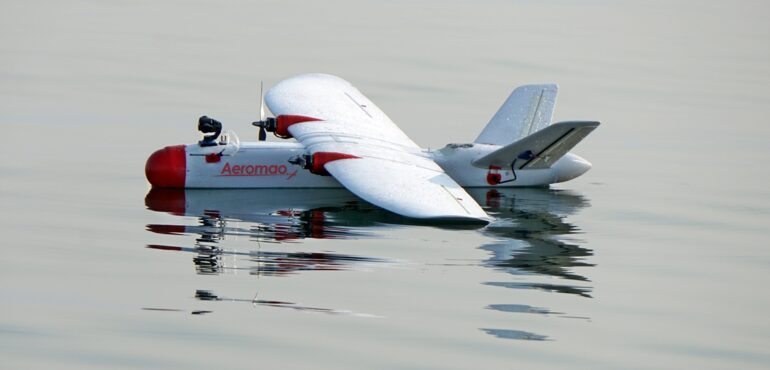
Fixed-wing drones, or UAVs, refer to planes with fixed wings. In contrast to multirotors, fixed-wing drones do not hover since their propellers move them in a forward direction. Instead, lift is generated because of the airflow caused by the aircraft’s speed. The use of airflow allows achieving more energy efficiency, thus increasing the drone’s range and endurance.
For these advantages, the fixed-wing drone is common among surveyors and mapmakers while doing extensive mapping jobs. In addition, almost all professional systems feature autonomous flight support when the operator plans a mission with the help of specific software, and the drone carries out planned actions independently. At Aeromao Inc., we have noticed that fixed-wing drones assist industries in mapping areas that are distant and unreachable.
How Fixed-Wing Drones Work in Surveying and Mapping
First, for fixed-wing UAV surveys, there must be planning involved. The region for surveying, flying altitude, overlap percentage, and flight path should all be planned using mission planning software. Once planning is done, the UAV is able to take off by itself following the programmed mission.
When the UAV is taking photos during flight, it captures high-quality photos from the earth’s surface. They will have an overlap to aid in the process of photogrammetry, while the use of RTK/PPK increases the accuracy of GPS location.
After finishing the mission, the photos obtained can be analyzed using mapping software to produce numerous deliverables, including:
- Orthomosaic maps
- Digital elevation models
- 3D terrain models
- Point clouds
- GIS-ready datasets
It is highly efficient in assessing the condition of the land, which is quite precise. The usage of drones is much more productive than any other approaches since drones significantly reduce labor expenses and the project completion time.
One of the most effective ways of surveying a huge territory would be using fixed-wing drones since they allow obtaining a stable result with a long-term flight period.
Key Advantages of Fixed-Wing Drones for Mapping Projects
Longer Flight Time
The main feature of the fixed-wing drone is its high endurance. Most commercial drones can remain in the air for up to two hours, depending on what load they carry and the weather conditions. Put otherwise, an operator can cover a lot of ground with a single takeoff.
Increased Flight Time
Increased flight time decreases the time spent on battery swapping and repeated takeoffs, allowing for fast completion of the task at hand and reducing expenses on flights.
Higher Rate of Area Coverage
Fixed-wing drones have far faster flight speeds than multirotors, allowing them to inspect a large region in one takeoff. Fixed-wing UAVs are extensively employed in agriculture, mining, forestry, and mapping of corridors. A single trip by a fixed-wing UAV can scan hundreds of hectares, while several trips will be required for a multirotor UAV to achieve the same result.
Improved Operational Efficiency
Mapping operations require a quick turnaround under difficult climatic conditions. Using fixed-wing unmanned aerial vehicles can allow for reducing the number of flights and increasing the speed of gathering information. Efficient operations lead to better planning because the number of flights can be minimized while providing sufficient amounts of data.
Ability to Work in Hard-to-Reach Areas
A considerable amount of mapping tasks require working far away from civilization in remote places where road transportation cannot be considered as efficient as using unmanned vehicles. Long-distance flying drones are widely used in industries like forestry, ecology, and coastal monitoring, requiring prolonged flight time.
High Precision Geospatial Data
As more fields such as infrastructure construction, mining operations, agriculture, and environmental conservation become more prominent, regular surveying will no longer suffice. Using fixed-wing UAVs may be a viable solution. The wings of these drones make it easier to map bigger areas while remaining stable and taking high-quality images.
The following is a discussion of basic information about fixed-wing drones, the benefits they provide, and the reasons for their increasing use in the current age of surveying.
Fixed Wing Drone vs Multirotor Drone
Both the fixed-wing and multirotor unmanned aerial vehicles have their place in UAV-based business operations; however, both types are constructed to perform certain functions. When large-scale maps have to be created, fixed-wing drones come in handy. The multirotor type comes in handy when carrying out inspections.
The fixed-wing unmanned aerial vehicle is normally selected where the project involves:
- Long-distance corridor mapping
- Agricultural surveying
- Large land inspections
- Coastal or maritime monitoring
- Mining and forestry analysis
Multirotor drones are more practical for:
- Building inspections
- Roof assessments
- Detailed structural imaging
- Confined-space operations
Choosing the right platform depends on project size, terrain, flight duration, and data collection goals.
Industries That Use Fixed-Wing Drones
Land Surveying
Surveyors deploy fixed-wing UAVs to generate highly accurate maps, perform boundary surveys, and create digital terrain models. A UAV mapping system ensures increased efficiency by reducing time spent on-site.
Agricultural
The agricultural industry requires precision farming practices, which rely heavily on aerial data collection. Farmers and agronomists make use of drones capable of creating field maps.
Mining
Continuous assessment of mining operations is vital for monitoring mining sites, their excavations, and changing terrain. The usage of fixed-wing UAVs allows for collecting highly accurate geospatial data safely.
Forestry
Fixed-wing drones are used in the forestry industry to monitor forest density and assess environmental and land cover conditions.
Construction
The construction industry benefits greatly from the ability to monitor building progress and the planning of infrastructure using aerial mapping.
Environmental Monitoring
Nonprofit organizations that are dedicated to protecting the environment utilize drones to inspect wildlife habitats, wetlands, coastal regions, and other areas of interest.
Maritime Operations
There are also some fixed-wing drones that were designed to work both on land and at sea. Such aircraft help with monitoring coastal zones and performing offshore inspections.
At Aeromao Inc., we have helped a number of companies in different industries that required high-performing UAVs capable of operating in challenging maritime and terrestrial environments.
Important Features to Look for in a Fixed-Wing Drone
Choosing the right fixed-wing drone involves more than selecting a platform with a long flight time. Operators should evaluate several important factors before investing in a UAV system.
- Flight Endurance
Longer endurance increases productivity and allows larger survey areas to be covered during each mission. - Payload Compatibility
Professional UAV systems should support different sensors and cameras depending on project requirements. This may include RGB cameras, thermal sensors, or multispectral payloads. - RTK and PPK Support
High-accuracy positioning systems improve mapping precision and reduce post-processing complexity. - Wind Resistance
Strong flight stability is important for maintaining data quality during challenging weather conditions. - Communication Range
Reliable telemetry and communication systems help operators maintain safe and stable UAV operations over long distances. - Durability
Industrial drone operations often take place in rough environments. Durable airframes and rugged components improve reliability and long-term performance. - Autonomous Flight Capability
Advanced automation simplifies mission planning and helps operators maintain consistent mapping results.
Companies such as Aeromao Inc. continue developing fixed-wing UAV systems with practical features designed specifically for industrial surveying and long-range mapping operations.
Choosing the Right Fixed-Wing Drone for Your Operations
The choice of the most appropriate fixed-wing drone will be based on your requirements and the level of accuracy needed. When selecting an unmanned aircraft system (UAS), there are certain factors that should be considered prior to purchase.
Some key considerations include:
- Flight endurance and area coverage
- Camera and sensor compatibility
- RTK or PPK support for mapping accuracy
- Wind resistance and stability
- Communication range
- Ease of deployment and transport
- Software compatibility
- Long-term maintenance and support
Professional operators should also consider scalability. With growth, the drones will be required to have advanced processes and larger mission capabilities while retaining efficiency. This is something that we have realized here at Aeromao Inc., and our UAV technology solutions can help to meet your industrial needs by delivering performance, accuracy, and reliability in operations.
Conclusion
Fixed-wing UAV technology improvements have significantly impacted many sectors. Data acquisition during aerial surveys has been improved through increased speed, accuracy, and efficiency. These UAVs have improved the efficiency of work in various sectors such as mining, agriculture, construction, and environmental monitoring by reducing man-hours and field hours.
With increased interest in UAV mapping, Aeromao Inc. has been there to support industries with reliable fixed-wing drone systems suited for practical applications. Having gained considerable experience in long-range UAV mapping technology and advanced aerial systems, Aeromao Inc. is the right place to go for industries seeking high-quality surveying and mapping systems.
Contact Aeromao Inc. today to explore reliable fixed-wing UAV systems.
FAQs
What is a fixed wing drone used for?
A fixed wing drone is mainly used for large-scale aerial surveying, mapping, monitoring, and data collection. These UAVs are popular in industries such as agriculture, mining, forestry, construction, and environmental research because they can cover large areas efficiently.
Are fixed wing drones better for mapping?
Yes, fixed wing drones are generally better for mapping large regions because they offer longer flight times and greater coverage compared to multirotor drones. Their efficient flight design also helps improve productivity during aerial surveys.
How long can a fixed wing drone fly?
Flight duration depends on the UAV model, payload, and weather conditions. Many professional fixed wing drone systems can stay airborne for one to two hours during a single mission.
What industries use fixed wing UAVs?
Industries that commonly use fixed wing UAVs include land surveying, agriculture, mining, forestry, maritime operations, construction, oil and gas, and environmental monitoring.
Do fixed wing drones support RTK or PPK mapping?
Yes, many professional fixed wing drone systems support RTK and PPK technology. These positioning systems improve mapping accuracy and help generate precise geospatial data for surveying projects.