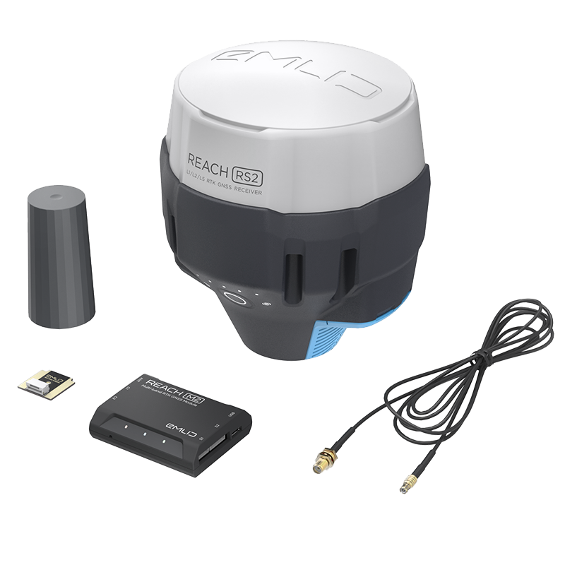
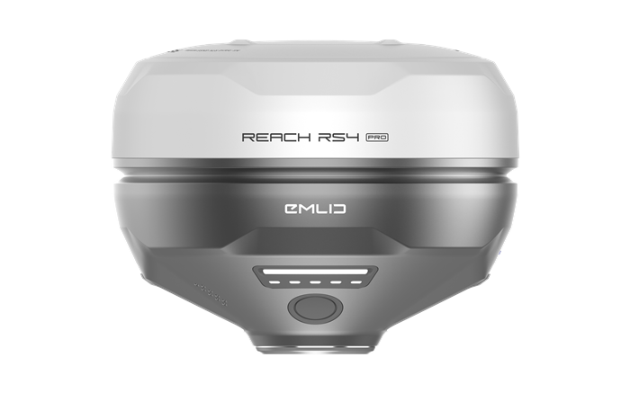
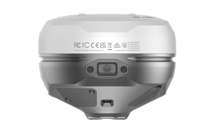
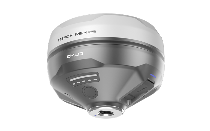
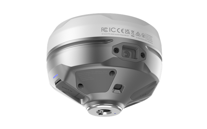
Aeromao Aeromao Aeromao
  • Home
  • About
  • PRODUCTS
    • VT-NAUT
    • Aeromapper Talon
    • Aeromapper Talon Amphibious
    • Emlid
    • DJI Drones
    • Surveying accessories
    • DJI Drones
    • Remote ID
    • Software
    • Shop
  • Services
  • Case Studies
  • News
  • Contact
  • Shop
  •  

Reach RS4 Pro

Reach RS4 Pro
Reach RS4 Pro - Image 2
Reach RS4 Pro - Image 3
Reach RS4 Pro - Image 4
Reach RS4 Pro - Image 5
Reach RS4 Pro - Image 6
Reach RS4 Pro - Image 7
Reach RS4 Pro - Image 8
Reach RS4 Pro - Image 9
Reach RS4 Pro - Image 10
Reach RS4 Pro - Image 11
Reach RS4 Pro - Image 12
Reach RS4 Pro - Image 13

Reach RS4 Pro

$6,129.00 CAD

All-band RTK GNSS receiver with dual cameras and tilt compensation

Next-level stakeout with augmented reality and measuring from photos. Comes with a mobile app.

Two Full-HD cameras: AR guidance for stakeout
Measurements from images

High precision: RTK: 7 mm + 1 ppm
Tilt compensation: RTK: 2 mm + 0.3 mm/°

All-band support

GPS: L1C/A, L2C, L5
GLONASS: L1OF, L2OF
Galileo: E1-B/C, E5a, E6
BeiDou: B1I, B1C, B2a, B3I
QZSS: L1C/A, L1C/B11, L2C, L5
NavIC: L1-SPS Data, L5-SPS

Base and rover: 915 MHz LoRa 450 MHz UHF NTRIP

Rugged and powerful: 16 hours on one charge. Magnesium alloy body IP68 rating. Withstands temperatures from -40 to +65°C (-40 to +149ºF)

Package includes

– Reach RS4 Pro
– Carrying case
– USB Type-C cable
– LoRa Antenna 860-930 MHz
– UHF Antenna 410-470 MHz

Category: Emlid
  • Description

Description

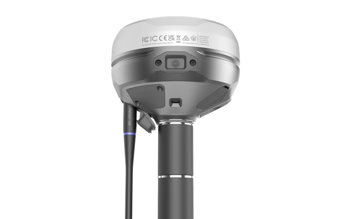
All-band RTK GNSS receiver with dual cameras. Visual stakeout and remote point capture for faster and safer work.

Discover the new way to survey with dual Full HD cameras and take surveying and stakeout further than traditional RTK can.

Stake out faster with AR guidance

With the RS4 Pro, stakeout becomes visual. Rather than simply following coordinates on a map, your designs are directly overlaid on the real world, clearly showing where to place stakes.

  • Dynamic navigation
  • Auto bullseye View
  • Cut & fill indicator
  • Quick point switch

Crews can work faster with AR guidance, even on complex construction sites and roadworks.
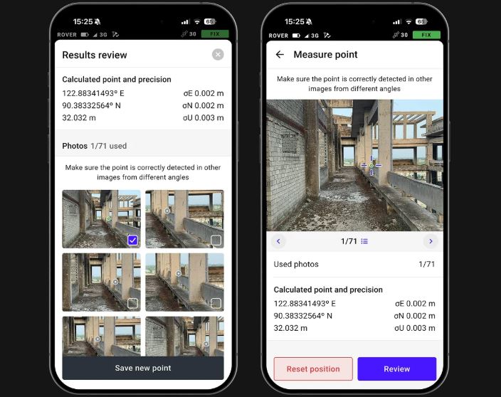
https://aeromao.com/wp-content/uploads/2025/10/Stakeout.webm

Measure from images

Even if you can’t put the pole there, you can still measure it with your RS4 Pro. Use the cameras to measure building facades, areas behind fences, across busy roads and any other inaccessible points.

Save time setting up a total station and avoid hazardous areas.

Across water/Behind fences/Over traffic/Above pits/Past hedges/Around machinery

Unmatched precision, even under canopy

https://aeromao.com/wp-content/uploads/2025/10/Accurate-under-tree-canopy.webm
The Reach RS4 Pro delivers centimeter-level accuracy, even in challenging environments like forests or urban canyons. With support for every GNSS constellation and signal frequency, including the L5 and L6 bands, resistant to multipath and interference, the Reach RS4 Pro locks onto 40+ satellites simultaneously using 672 channels.
  • Accuracy: 7mm + 1 ppm in RTK
  • Constellations: GPS, GLONASS, Galileo, BeiDou, QZSS, NavIC
  • Fix: Fix in under 5 seconds
  • Channels: 672 channels
  • Full-band support: L1 / L2 / L5 / L6

Next-gen tilt compensation

https://aeromao.com/wp-content/uploads/2025/10/New-gen-tilt.webm

The advanced tilt compensation stays accurate even at steep angles. For example, at a 30° tilt, the Reach RS4 Pro still delivers 18 mm precision. Initialization takes just a few quick movements and remains stable throughout the job—no manual recalibration needed.

  • Factory calibrated
  • Rapid initialization
  • Immune to interferences
  • Unlimited tilt angles
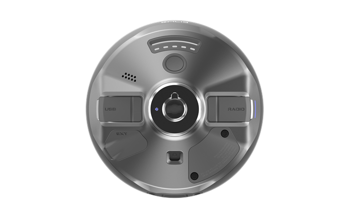
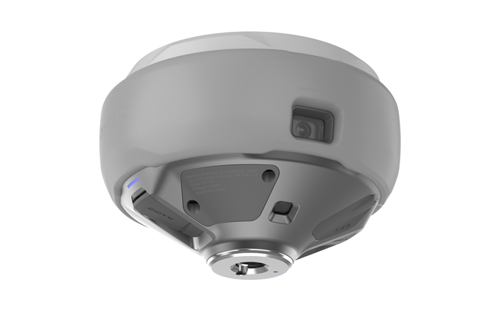
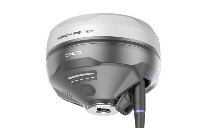
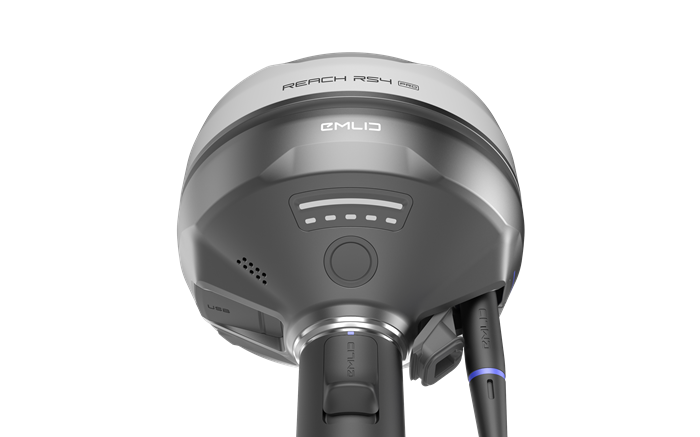
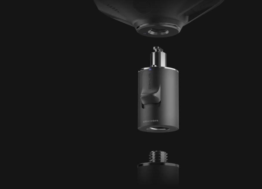
Quick release mount

The custom-designed quick release mount ensures the receiver is locked firmly to your survey pole, eliminating backlash. Even the smallest wobble can affect tilt-based measurements at steeper angles. This mount solves the issue with a fast and rock-solid connection for reliable data accuracy. Mount available here

Base and rover connectivity

NTRIP: Connect to VRS or single-base CORS networks using RTCM3 format for precise RTK corrections. You can also transmit corrections from your own base using Emlid NTRIP Caster

Dual-band radio

UHF 450 MHz

Transmit and receive
Up to 2W ( may require a license)
Compatible with Reach and 3rd-party receivers with TRIMTALK 450S support3

LoRa 915 MHz

Transmit and receive
Up to 1W (license-free in North America)
Compatible with Reach receivers

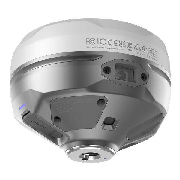
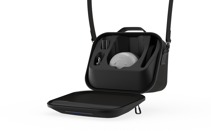
Engineered for the harshest environments

Magnesium alloy body

Crafted from the same material used in aerospace and high-end tech, the Reach RS4 Pro magnesium body offers exceptional strength without the extra weight. It’s rugged enough for demanding job sites—and light enough for all-day use.

Waterproof

From rainstorms to dusty construction sites, the Reach RS4 Pro is fully ready. With an IP68 rating, it’s completely sealed against water and debris.

16 hours on one charge

No need to stop mid-job to recharge. The Reach RS4 Pro runs up to 16 hours on a single charge. Power up via USB-C or plug in a power bank on the go—maximum uptime, minimum hassle.

-40 to +65 ºС

From cold to heat, the Reach RS4 Pro performs without compromise. Engineered to operate flawlessly between -40°C and +65°C, it’s ready for work anywhere.

Software to drive your entire workflow

The Reach RS4 Pro is powered by Emlid Flow—a complete field and cloud solution for iOS and Android. From initial setup to final verification, Emlid Flow keeps your entire team connected, your data synchronized, and your project on track.

https://aeromao.com/wp-content/uploads/2025/10/Emlid-Flow-Software.webm

Keep your team in sync

  • Invite team members, assign roles, and share projects
  • Monitor field progress from the office and sync data instantly with the field
  • Unified workflows for all team members, consistent interface, no extra training needed

Handle all types of fieldwork

  • Topographic surveys: capture precise elevation and terrain data
  • Stakeout & layout: mark points, lines, and site boundaries
  • Line & road surveys – stake centerlines and offsets with precision
  • Cut & fill calculations: measure stockpiles and earthworks on-site
  • As-builts: confirm construction accuracy against design plans

Specifications

  • Dimensions: 128.6 x 128.6 x 99.3 mm
  • Weight: 920 g
  • Operating temperatures: -40 to +65 °C
  • Ingress protection: IP 68
  • Autonomy: 16 hrs as RTK rover with tilt
  • Battery: Li-Ion 5000 mAh, 7.2 V 36 Wh
  • Static Accuracy: H: 4 mm + 0.5 ppm / V: 8 mm + 1 ppm
  • PPK: H: 5 mm + 0.5 ppm / V: 10 mm + 1 ppm
  • RTK: H: 7 mm + 1 ppm / V: 14 mm + 1 ppm
  • Tilt compensation: RTK + 2 mm + 0.3 mm/°
  • Convergence time: ~5 s typically

Connectivity

  • LoRa radio up to 1W
    • Frequency range: 868/915 MHz
    • Distance: Up to 8km
  •  UHF Radio up to 2W
    • Frequency Range: 410–470 MHz
    • Protocols: TRIMTALK 450S**
    • Modulation Type: GMSK
  • LTE Modem:
    • Region: Global
    • Bands: FDD-LTE: 1, 2, 3, 4, 5,
      7, 8, 12, 13,
      18, 19, 20, 26, 28
      TD-LTE: 38, 39, 40, 41
      UMTS (UHPS/FDD):
      1, 2, 5, 8
      Quad-band, 850/1900
      900/1800 MHz
    • Sim Card: Nano-SIM
  • Wi-Fi: 802.11a/b/g/n
  • Bluetooth: 5.1 (BR/EDR + LE)
  • Ports: RS-232, USB Type-C

Data

  • Corrections: NTRIP, RTCM3
  • Position output: NMEA, LLH/XYZ
  • Data logging: RINEX, NMEA, LLH/XYZ, UBX
  • Internal storage: 16 GB

GNSS

  • Signal tracked: PS: L1C/A, L2C, L5,
    GLONASS: L1OF, L2OF,
    Galileo: E1-B/C, E5a, E6,
    BeiDou: B1I, B1C, B2a, B3I,
    QZSS: L1C/A, L1C/B11, L2C, L5,
    NavIC: L1-SPS Data, L5-SPS
  • Number of channels: 672
  • Update rates: up to 10 Hz
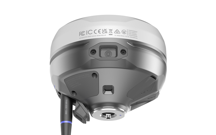
Imaging

  • Image sensors: 1/2.6 in, CMOS, global shutter, Full HD
  • Field of View:
    • Front camera: H: 64.6°, V: 42.8°
    • Bottom camera: H: 63°, V: 42°
  • Video Frame: 25 fps

Related products

  • Sale! Reach RX KitReach RX Kit $2,999.00 CAD Original price was: $2,999.00 CAD.$2,899.00 CADCurrent price is: $2,899.00 CAD. Add to cart
    Reach RX Kit
    $2,999.00 CAD Original price was: $2,999.00 CAD.$2,899.00 CADCurrent price is: $2,899.00 CAD.
  • Sale! Pix4D & EMLID Scanning Kit STANDARD - w/Reach RXPix4D & EMLID Scanning Kit STANDARD – w/Reach RX $6,579.00 CAD Original price was: $6,579.00 CAD.$5,142.00 CADCurrent price is: $5,142.00 CAD. Add to cart
    Pix4D & EMLID Scanning Kit STANDARD – w/Reach RX
    $6,579.00 CAD Original price was: $6,579.00 CAD.$5,142.00 CADCurrent price is: $5,142.00 CAD.
  • Reach M2 with GNSS AntennaReach M2 with GNSS Antenna $1,297.00 CAD Add to cart
    Reach M2 with GNSS Antenna
    $1,297.00 CAD
Recent Posts
  • Emlid Flow Localization feature and major updates September 18, 2023
  • DJI Mavic 3E with Reach RS2+ base June 7, 2023
  • Aeromao wins Bid to supply water-landing Aeromapper Talons to United Nations FAO Philippines December 29, 2022
  • The Ocean Clean Up & Oceans Unmanned chose Aeromapper Talon Amphibious for second year in a row December 29, 2022
  • Talon Amphibious used to detect Illegal fishing December 29, 2022
  • Drones for Environmental Protection July 6, 2021
  • Aeromapper Talon Amphibious Routinely Fly BVLOS Missions Over Marine Reserve For Illegal Fishing Detection And Biodiversity Research. August 2, 2019

UAV manufacturer and developer of the unmanned aerial vehicles for mapping, surveying, precision agriculture and remote sensing.

Support : 1-647–928–4747
Mon to Fri : 9:00am – 5:00pm
Email : info@aeromao.com

Latest News

  • Emlid Flow Localization feature and major updates September 18, 2023
  • DJI Mavic 3E with Reach RS2+ base June 7, 2023
  • Aeromao wins Bid to supply water-landing Aeromapper Talons to United Nations FAO Philippines December 29, 2022

Our Products

  • VT-NAUT
  • Payloads & Accessories
  • Emlid
  • Fixed Wing Drones
  • Software
  • Surveying accessories

Social Links

payment-methods

©2024 Aeromao Inc. All Rights Reserved.
Store Policy | Terms & Conditions